The sun sets over the Paducah and Louisville Railway as the sun rakes across the ice-covered trees at Richland, Ky on February 5th, 2022, in this ultrawide angle shot from my DJI Air 2S drone. 

The recent weather front that passed through the region left a spectacular display of ice in the trees for several days. Thankfully it didn’t cause much disruption in my area, unlike the last ice storm through here that left me without power for 6 days in 2009!

Tech Info: DJI Mavic Air 2 Drone, RAW, 4.5mm (24mm equivalent lens) f/2.8, 1/1000, ISO 110, underexposed by 3 stops for the sun.

#trainphotography #railroadphotography #trains #railways #jimpearsonphotography #trainphotographer #railroadphotographer

The setting sun over the Paducah and Louisville Railway at Richland, Kentucky

The sun sets over the Paducah and Louisville Railway as the sun rakes across the ice-covered trees at Richland, Ky on February 5th, 2022, in this ultrawide angle shot from my DJI Air 2S drone.

The recent weather front that passed through the region left a spectacular display of ice in the trees for several days. Thankfully it didn’t cause much disruption in my area, unlike the last ice storm through here that left me without power for 6 days in 2009!

Tech Info: DJI Mavic Air 2 Drone, RAW, 4.5mm (24mm equivalent lens) f/2.8, 1/1000, ISO 110, underexposed by 3 stops for the sun.

Dock, Lake Pee Wee, Madisonville, Kentucky 

I've enjoyed returning to this dock for many years now and photographing it in various conditions and todays view is from my Infrared perspective! I've got other thoughts on shooting this dock, but I must wait till the conditions and time of day are just right.

It's always a good exercise to have a location or scene in your photographic life that you can return to from time to time to stretch your vision and see what new views you can find!

Tech Info: Fuji XT-1, RAW, Converted to 720nm B&W IR, Fuji 18-55 @18mm, f/5, 1/1000, ISO 200.

Dock, Lake Pee Wee, Madisonville, Kentucky

I’ve enjoyed returning to this dock for many years now and photographing it in various conditions and todays view is from my Infrared perspective! I’ve got other thoughts on shooting this dock, but I must wait till the conditions and time of day are just right.

It’s always a good exercise to have a location or scene in your photographic life that you can return to from time to time to stretch your vision and see what new views you can find!

Tech Info: Fuji XT-1, RAW, Converted to 720nm B&W IR, Fuji 18-55 @18mm, f/5, 1/1000, ISO 200.

WEB-06.27.19 Burgess Falls 2, Cookeville, TN

Burgess Falls State Park…

June 27, 2019 – Burgess Falls State Park is a state park and state natural area in Putnam County and White County, Tennessee. According to Wikipedia: Burgess Falls State Park is a state park and state natural area in Putnam County and White County, Tennessee, located in the southeastern United States. The park is situated around a steep gorge in which the Falling Water River drops 250 feet (76 m) in elevation in less than a mile, culminating in a 136-foot (41 m) cataract waterfall.

WEB-06.27.19 Burgess Falls 1, Cookeville, TN

Burgess Falls State Park…

June 27, 2019 – Burgess Falls State Park is a state park and state natural area in Putnam County and White County, Tennessee. According to Wikipedia: Burgess Falls State Park is a state park and state natural area in Putnam County and White County, Tennessee, located in the southeastern United States. The park is situated around a steep gorge in which the Falling Water River drops 250 feet (76 m) in elevation in less than a mile, culminating in a 136-foot (41 m) cataract waterfall.

June 27, 2019 - Burgess Falls State Park is a state park and state natural area in Putnam County and White County, Tennessee. According to Wikipedia: Burgess Falls State Park is a state park and state natural area in Putnam County and White County, Tennessee, located in the southeastern United States. The park is situated around a steep gorge in which the Falling Water River drops 250 feet (76 m) in elevation in less than a mile, culminating in a 136-foot (41 m) cataract waterfall.

Burgess Falls State Park…

June 27, 2019 – A Lone Tree stands strong in the flowing waters through the Burgess Falls State Park. It is a state park and state natural area in Putnam County and White County, Tennessee, located in the southeastern United States. The park is situated around a steep gorge in which the Falling Water River drops 250 feet (76 m) in elevation in less than a mile, culminating in a 136-foot (41 m) cataract waterfall.

June 26, 2019 - My favorite waterfall picture from today is of the City Lake Falls in Cookeville, Tennessee.

My favorite waterfall picture from today…

June 26, 2019 – My favorite waterfall picture from today is of the City Lake Falls in Cookeville, Tennessee. I’ll be up here shooting one of my other loves for the next few days and hopefully I’ll be able to catch a train on the Nashville & Eastern before I head back home! I tried today for a few hours and only got a couple good waiting on a train photos!

WEB-05.27.19 Green Bank Observatory with barns at Green Bank, WV

Like trains, I enjoy photographing old barns…

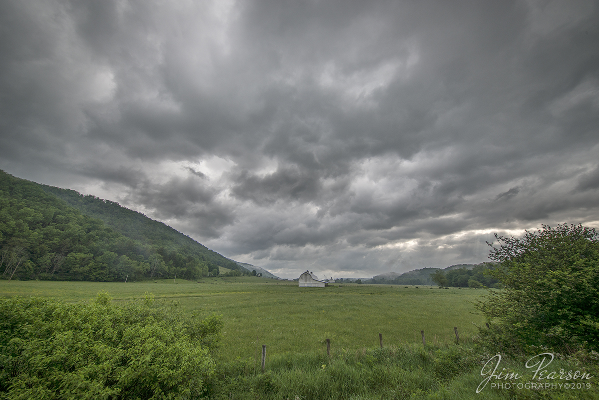
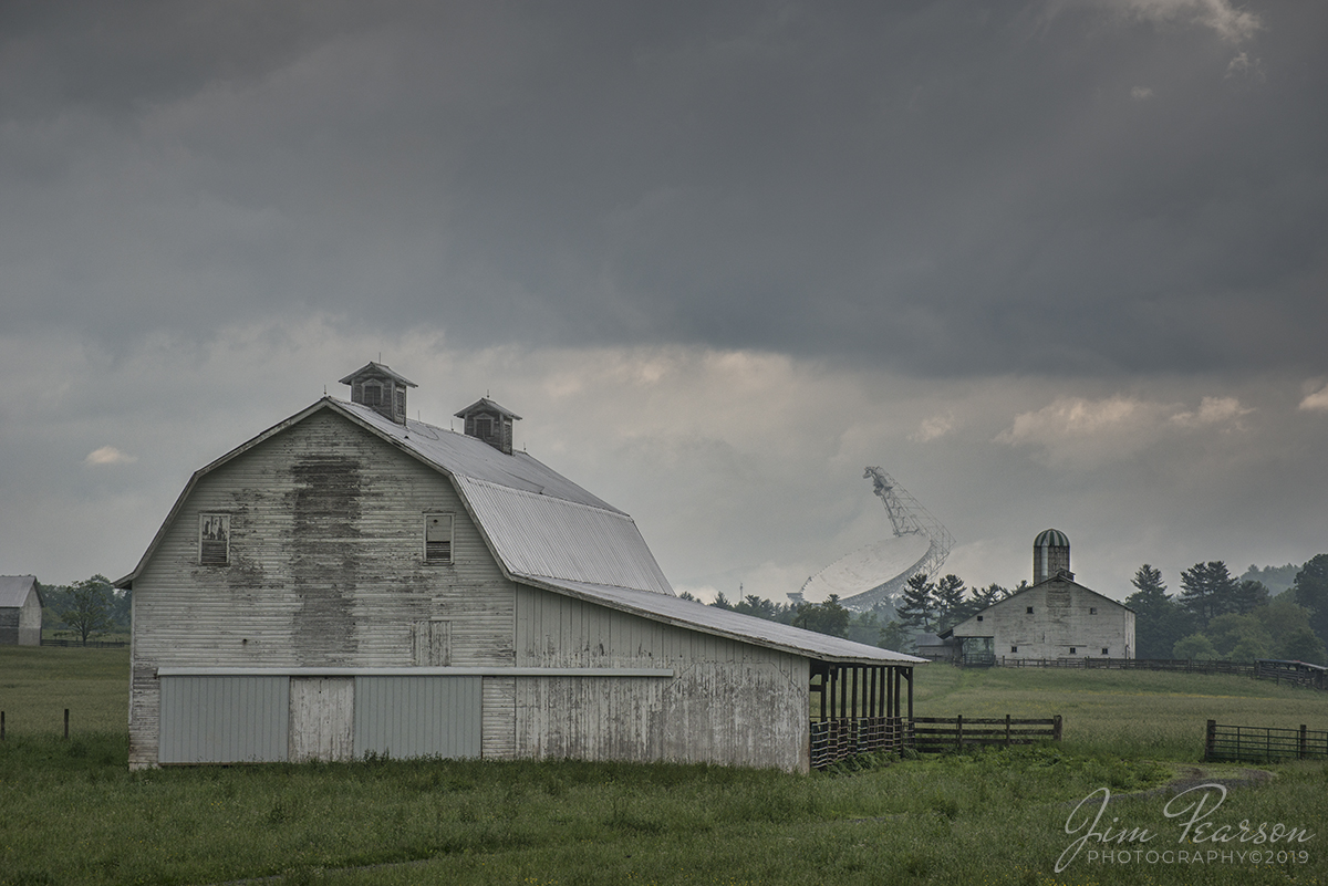
May 27, 2019 – Like trains, I enjoy photographing old barns when I find them, such as these. However, I really enjoy it when I find something out of the ordinary to include with the barn such as this shot of the Green Bank Telescope just outside of Cass at Green Bank, West Virginia.

According to Wikipedia: The Robert C. Byrd Green Bank Telescope (GBT) in Green Bank, West Virginia, US is the world’s largest fully steerable radio telescope. The Green Bank site was part of the National Radio Astronomy Observatory (NRAO) until September 30, 2016. Since October 1, 2016, the telescope has been operated by the newly separated Green Bank Observatory. The telescope honors the name of the late Senator Robert C. Byrd who represented West Virginia and who pushed the funding of the telescope through Congress.

The Green Bank Telescope operates at meter to millimeter wavelengths. Its 100-meter diameter collecting area, unblocked aperture, and good surface accuracy provide superb sensitivity across the telescope’s full 0.1–116 GHz operating range. The GBT is fully steerable, and 85% of the entire local celestial hemisphere is accessible. It is used for astronomy about 6500 hours every year, with 2000–3000 hours per year going to high-frequency science. Part of the scientific strength of the GBT is its flexibility and ease of use, allowing for rapid response to new scientific ideas. It is scheduled dynamically to match project needs to the available weather. The GBT is also readily reconfigured with new and experimental hardware. The high-sensitivity mapping capability of the GBT makes it a necessary complement to the Atacama Large Millimeter Array, the Expanded Very Large Array, the Very Long Baseline Array, and other high-angular resolution interferometers. Facilities of the Green Bank Observatory are also used for other scientific research, for many programs in education and public outreach, and for training students and teachers.

The telescope began regular science operations in 2001, making it one of the newest astronomical facilities of the US National Science Foundation. It was constructed following the collapse of a previous telescope at Green Bank, a 90.44 m paraboloid erected in 1962. The previous telescope collapsed on 15 November 1988 due to the sudden loss of a gusset plate in the box girder assembly, which was a key component for the structural integrity of the telescope.

WEB-03.24.19 Windpoint Lighthouse 1, Racine, WI

Wind Point Lighthouse, WI

March 24, 2019 – Well, my attempt at photographing the northern lights was a bust on my Chicago trip last weekend, but it did result in a few nice photographs of the Wind Point Lighthouse which I post here for your enjoyment!

According to Wikipedia, Wind Point Lighthouse is a lighthouse located at the north end of Racine Harbor in the U.S. state of Wisconsin. It is in the village of Wind Point, Wisconsin, on Lighthouse Road. The lighthouse stands 108 feet tall.

The Wind Point Lighthouse is one of the oldest and tallest still operating on Lake Michigan.

The Lighthouse was built in 1880 and was designed by Orlando Metcalfe Poe who had served in the Civil War as a Brigadier General. After the war, he served as engineer secretary of the Lighthouse Board and was in charge of lighthouse construction. It was lit for the first time on November 15, 1880.

March 9, 2019 - A rainbow appears to end on the CSX Henderson Subdivision at Trenton, Ky after a heavy storm passes through the area. Unfortunately with the signals red in both directions I wasn't lucky enough catch a northbound train approaching me at the crossing at the north end of the Trenton siding. Still, it's not always about a train, is it! - #jimstrainphotos #kentuckyrailroads #trains #nikond800 #railroad #railroads #train #railways #railway #csx #csxrailroad

March 9, 2019 – A rainbow appears to end…

March 9, 2019 – A rainbow appears to end on the CSX Henderson Subdivision at Trenton, Ky after a heavy storm passes through the area. Unfortunately with the signals red in both directions I wasn’t lucky enough catch a northbound train approaching me at the crossing at the north end of the Trenton siding. Still, it’s not always about a train, is it! – #jimstrainphotos #kentuckyrailroads #trains #nikond800 #railroad #railroads #train #railways #railway #csx #csxrailroad