CSX President's Special southbound at Rahm, Indiana

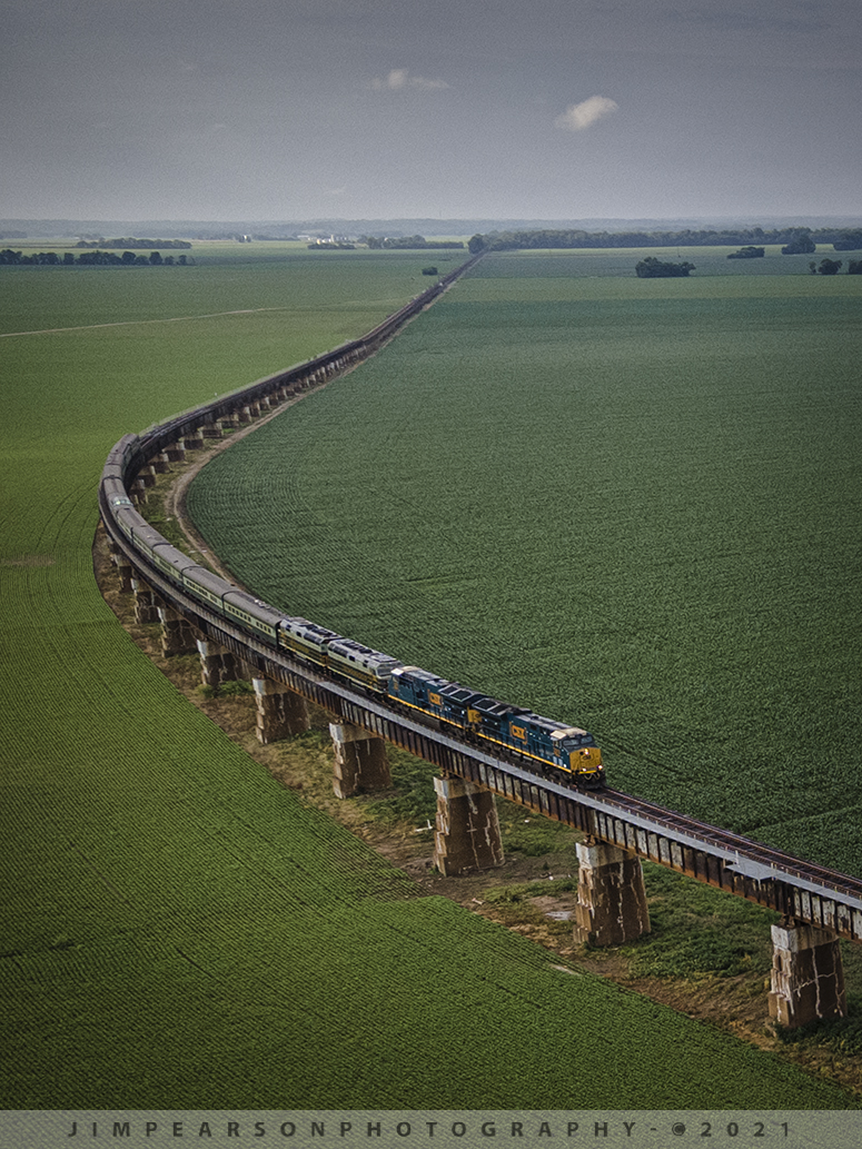
CSX President's Passenger train P001 heads south up the viaduct approaching the bridge over the Ohio River at Henderson, KY from Rahm, IN, with CSX GEVO units 3310, 3271 leading and CSXT 1 & 2 trailing as they pull 11 cars at a little over 1,000 ft long. 

CSX has repainted two of its F40PH locomotives, to be used on its business train, into predecessor Baltimore & Ohio's blue, gray, and black paint scheme. CSX1 is former 9998 (former Amtrak 288) and from what I can find out CSXT 2 is the former F40PH 9993 (former Amtrak 395). The other F40s are expected to be painted in the same scheme in the coming months as they are cycled through the shops.

Tech Info: Wide Photo: DJI Mavic Air 2 Drone, RAW, 4.5mm (24mm equivalent lens) f/2.8, 1/500, ISO 100, June 10, 2021. 

#trainphotography #railroadphotography #trains #railways #dronephotography #jimpearsonphotography

CSX President’s Special southbound at Rahm, Indiana

CSX President’s Passenger train P001 heads south up the viaduct approaching the bridge over the Ohio River at Henderson, KY from Rahm, IN, with CSX GEVO units 3310, 3271 leading and CSXT 1 & 2 trailing as they pull 11 cars at a little over 1,000 ft long.

CSX has repainted two of its F40PH locomotives, to be used on its business train, into predecessor Baltimore & Ohio’s blue, gray, and black paint scheme. CSX1 is former 9998 (former Amtrak 288) and from what I can find out CSXT 2 is the former F40PH 9993 (former Amtrak 395). The other F40s are expected to be painted in the same scheme in the coming months as they are cycled through the shops.

Tech Info: Wide Photo: DJI Mavic Air 2 Drone, RAW, 4.5mm (24mm equivalent lens) f/2.8, 1/500, ISO 100, June 10, 2021.

PAL loaded coal headed north through the valley at Spring Lick, Kentucky

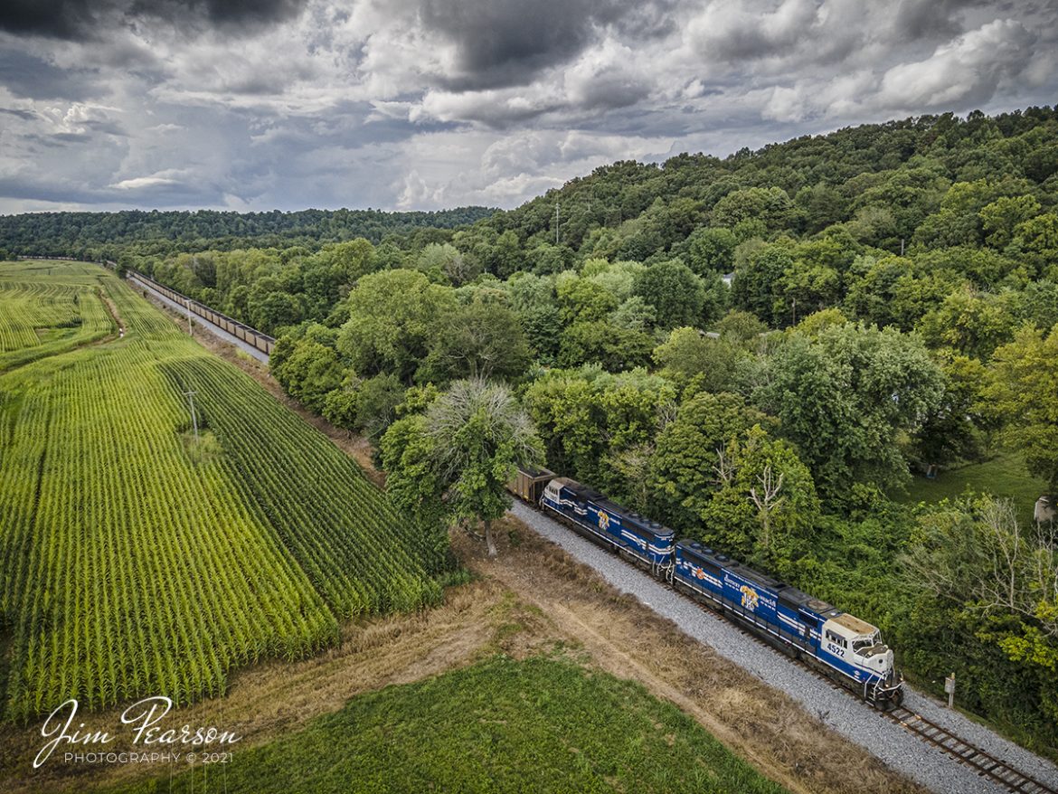
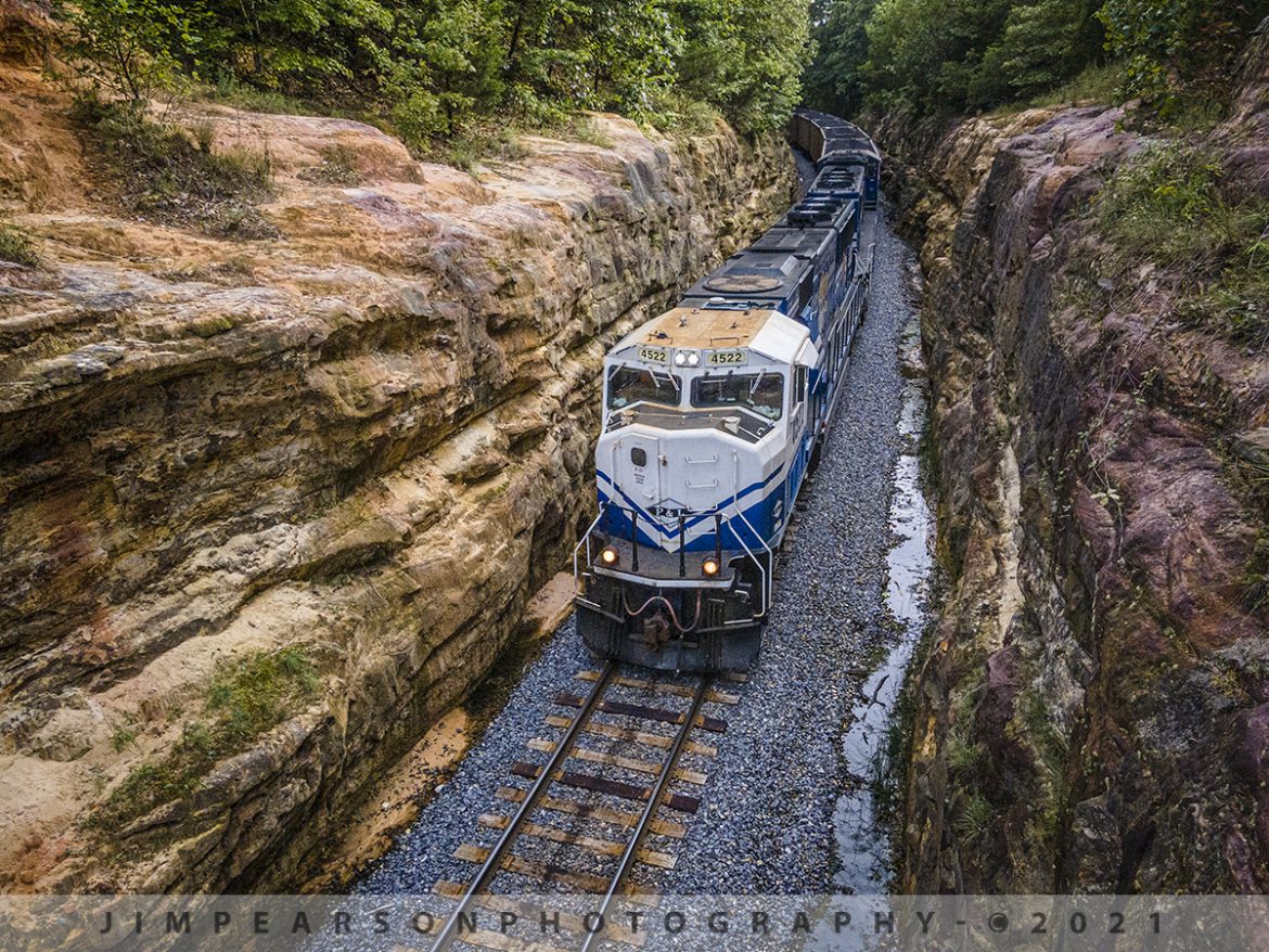
Paducah and Louisville University of Kentucky locomotives 4522 and 2012 lead the Louisville Gas & Electric loaded coal train north through the valley at Spring Lick, Kentucky on its way to the Louisville Gas and Electric power plant in the Kosmosdale neighborhood of Louisville, Kentucky.

From the web: "The Paducah and Louisville Railway (reporting marks, PAL) is a regional operation based in Paducah, Kentucky that began operations in 1986 over ex-Illinois Central trackage.

Today it utilizes over 260 miles of railroad and is owned by P&L Transportation (previously known as Four Rivers Transportation), which itself is controlled by CSX Corporation (parent company to CSX Transportation, its railroad division). 

The P&L also operates the Appalachian & Ohio in West Virginia.  This road is predominately a coal hauler, which leases CSX's Cowen Subdivision, a former Baltimore & Ohio corridor."

Tech Info: Wide Photo: DJI Mavic Air 2 Drone, RAW, 4.5mm (24mm equivalent lens) f/2.8, 1/640, ISO 100, August 17, 2021.

PAL loaded coal headed north through the valley at Spring Lick, Kentucky

Paducah and Louisville University of Kentucky locomotives 4522 and 2012 lead the Louisville Gas & Electric loaded coal train north through the valley at Spring Lick, Kentucky on its way to the Louisville Gas and Electric power plant in the Kosmosdale neighborhood of Louisville, Kentucky.

From the web: “The Paducah and Louisville Railway (reporting marks, PAL) is a regional operation based in Paducah, Kentucky that began operations in 1986 over ex-Illinois Central trackage.

Today it utilizes over 260 miles of railroad and is owned by P&L Transportation (previously known as Four Rivers Transportation), which itself is controlled by CSX Corporation (parent company to CSX Transportation, its railroad division).

The P&L also operates the Appalachian & Ohio in West Virginia. This road is predominately a coal hauler, which leases CSX’s Cowen Subdivision, a former Baltimore & Ohio corridor.”

Tech Info: Wide Photo: DJI Mavic Air 2 Drone, RAW, 4.5mm (24mm equivalent lens) f/2.8, 1/640, ISO 100, August 17, 2021.

A view from the top of PAL LG1 Northbound to Louisville, Kentucky

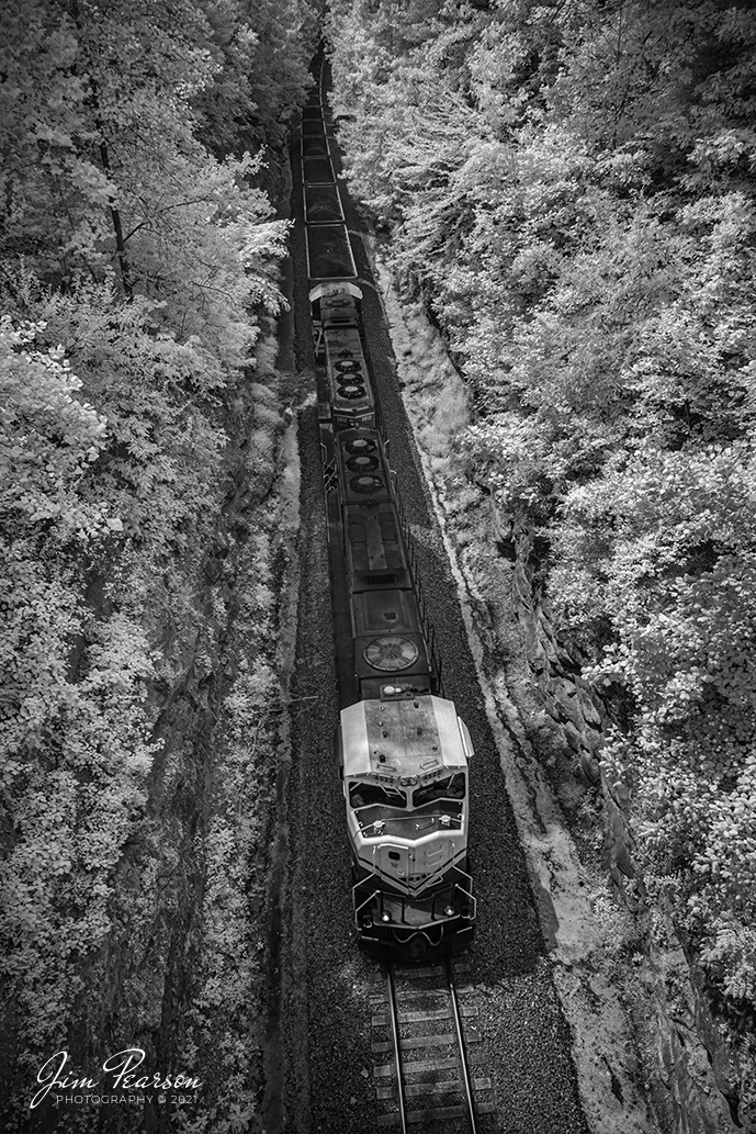
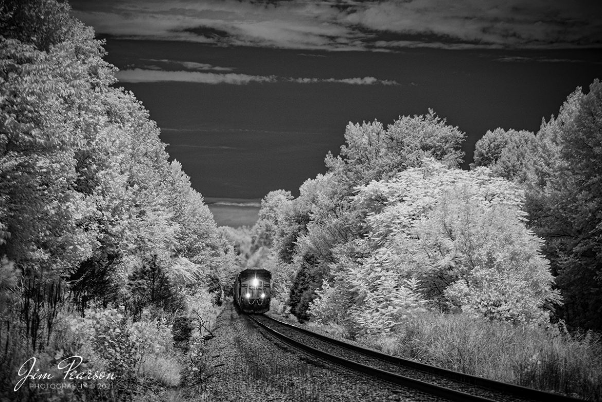
An infrared shot (taken the now old fashion way) from the overpass on highway 85, a few miles south of Central City, Kentucky as Paducah and Louisville Railways Louisville Gas and Electric loaded coal train, LG1, passes through the cut there on its way north with another load for the power plant, as PAL University of Kentucky locomotives, 4522 and 2012 lead the way.

Tech Info: Fuji XT-1, RAW, Converted to 720nm B&W IR, Fuji 18-55 @18mm, f/2.8, 1/500, ISO 200, August 13, 2021.

Paducah and Louisville Railway loaded coal at Big Clifty, Kentucky

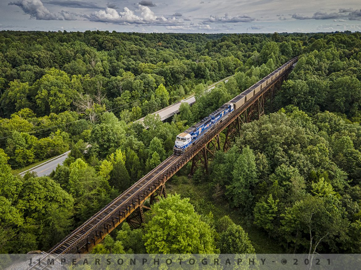
Paducah and Louisville University of Kentucky locomotives 4522 and 2012 lead the Louisville Gas & Electric loaded coal train across the trestle at Big Clifty, Kentucky as it heads north along highway 62 on its way to the Louisville Gas and Electric power plant in the Kosmosdale neighborhood of Louisville, Kentucky.

According to their website: "The Mill Creek Generation Station is LG&E's largest coal-fired power plant, with a generating capacity of 1,465 megawatts. Mill Creek sits on 544 acres in southwest Jefferson County, Ky.

The late 1960s and early 1970s saw an unprecedented increase in the construction of new industrial, commercial, and residential facilities in the Louisville area.

As customers  demand for energy increased, LG&E needed additional generating capability to guarantee supply and ensure reliability. Mill Creek began commercial operation in 1972 to meet this growing demand."

Tech Info: Wide Photo: DJI Mavic Air 2 Drone, RAW, 4.5mm (24mm equivalent lens) f/2.8, 1/640, ISO 100, August 17, 2021.

Paducah and Louisville Railway loaded coal at Big Clifty, Kentucky

Paducah and Louisville University of Kentucky locomotives 4522 and 2012 lead the Louisville Gas & Electric loaded coal train across the trestle at Big Clifty, Kentucky as it heads north along highway 62 on its way to the Louisville Gas and Electric power plant in the Kosmosdale neighborhood of Louisville, Kentucky.

According to their website: “The Mill Creek Generation Station is LG&E’s largest coal-fired power plant, with a generating capacity of 1,465 megawatts. Mill Creek sits on 544 acres in southwest Jefferson County, Ky.

The late 1960s and early 1970s saw an unprecedented increase in the construction of new industrial, commercial, and residential facilities in the Louisville area.

As customers demand for energy increased, LG&E needed additional generating capability to guarantee supply and ensure reliability. Mill Creek began commercial operation in 1972 to meet this growing demand.”

Tech Info: Wide Photo: DJI Mavic Air 2 Drone, RAW, 4.5mm (24mm equivalent lens) f/2.8, 1/640, ISO 100, August 17, 2021.

Northbound LG1 at Eastview Cut, Eastview, Kentucky

I spent this afternoon chasing the Paducah and Louisville Railway LG1 loaded coal train from Madisonville to Eastview, Kentucky. The latter was my goal for this chase as I've never photographed the cut at Eastview before and it's been on my list for a while now.

I got to the location about 10 minutes before the train and checked out the scene with my Nikon first as the cut is right up against the bridge on Meeting Creek Road and I wasn't sure I wanted or even needed to use the drone at this location. After consideration I decided to launch the drone as I felt it could give me the best platform for a shot that would offer the best perspective that was different from other photos I've seen taken from here.

With the drone in place, it was a short wait as I captured Paducah and Louisville University of Kentucky locomotives 4522 and 2012 lead the Louisville Gas & Electric loaded coal train as it made its way north and through the cut at Eastview, Kentucky.

Tech Info: Wide Photo: DJI Mavic Air 2 Drone, RAW, 4.5mm (24mm equivalent lens) f/2.8, 1/500, ISO 100, August 17, 2021.

Northbound LG1 at Eastview Cut, Eastview, Kentucky

I spent this afternoon chasing the Paducah and Louisville Railway LG1 loaded coal train from Madisonville to Eastview, Kentucky. The latter was my goal for this chase as I’ve never photographed the cut at Eastview before and it’s been on my list for a while now.

I got to the location about 10 minutes before the train and checked out the scene with my Nikon first as the cut is right up against the bridge on Meeting Creek Road and I wasn’t sure I wanted or even needed to use the drone at this location. After consideration I decided to launch the drone as I felt it could give me the best platform for a shot that would offer the best perspective that was different from other photos I’ve seen taken from here.

With the drone in place, it was a short wait as I captured Paducah and Louisville University of Kentucky locomotives 4522 and 2012 lead the Louisville Gas & Electric loaded coal train as it made its way north and through the cut at Eastview, Kentucky.

Tech Info: Wide Photo: DJI Mavic Air 2 Drone, RAW, 4.5mm (24mm equivalent lens) f/2.8, 1/500, ISO 100, August 17, 2021.

CSX Q503 southbound out of Mortons Gap, KY

It was a hot, muggy, and sunny kind of day as CSXT 797 lead CSX Q503 pulling south out of Mortons Gap, Kentucky on the Henderson Subdivision, approaching the location known as Oak Hill on the railroad, allowing me the opportunity to capture this this infrared photograph.

Tech Info: Fuji XT-1, RAW, sensor converted to 720nm B&W IR, Fuji 18-55 @50mm, f/5, 1/1000, ISO 200, August 13, 2021.

Trains and barges on and over the Ohio River at Henderson, KY

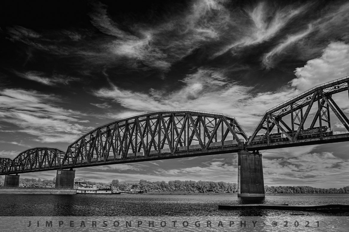
In this Infrared shot from August 13th, 2021, my plan was to catch two barges passing each other under the bridge on the Ohio River at Henderson, Kentucky while I was waiting for military train CSX W816 to make its way south on the Henderson Subdivision. 

I never expected the train to head over the river during this moment, as I hadn’t heard it call the ballast deck (last place they call on the scanner before hitting the bridge) before I got out of the car and decided to grab the barge shot in infrared while I was waiting. If I had known, it was this close I would have put my drone up for this shot! Not that I'm complaining at all though!

The containers behind the power contain the munitions for the last half of the train, which was armor, consisting of Bradley Fighting Vehicles and M1 Tanks.

Tech Info: Fuji XT-1, RAW, Converted to 720nm B&W IR, Fuji 18-55 @18mm, f/3.6, 1/500, ISO 200.

Trains and barges on and over the Ohio River at Henderson, KY

In this Infrared shot from August 13th, 2021, my plan was to catch two barges passing each other under the bridge on the Ohio River at Henderson, Kentucky while I was waiting for military train CSX W816 to make its way south on the Henderson Subdivision.

I never expected the train to head over the river during this moment, as I hadn’t heard it call the ballast deck (last place they call on the scanner before hitting the bridge) before I got out of the car and decided to grab the barge shot in infrared while I was waiting. If I had known, it was this close I would have put my drone up for this shot! Not that I’m complaining at all though!

The containers behind the power contain the munitions for the last half of the train, which was armor, consisting of Bradley Fighting Vehicles and M1 Tanks.

Tech Info: Fuji XT-1, RAW, Converted to 720nm B&W IR, Fuji 18-55 @18mm, f/3.6, 1/500, ISO 200.

Southbound Military move on the CSX Henderson Subdivision at Trenton, KY

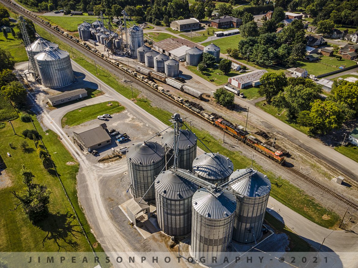
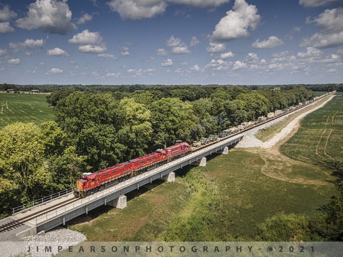
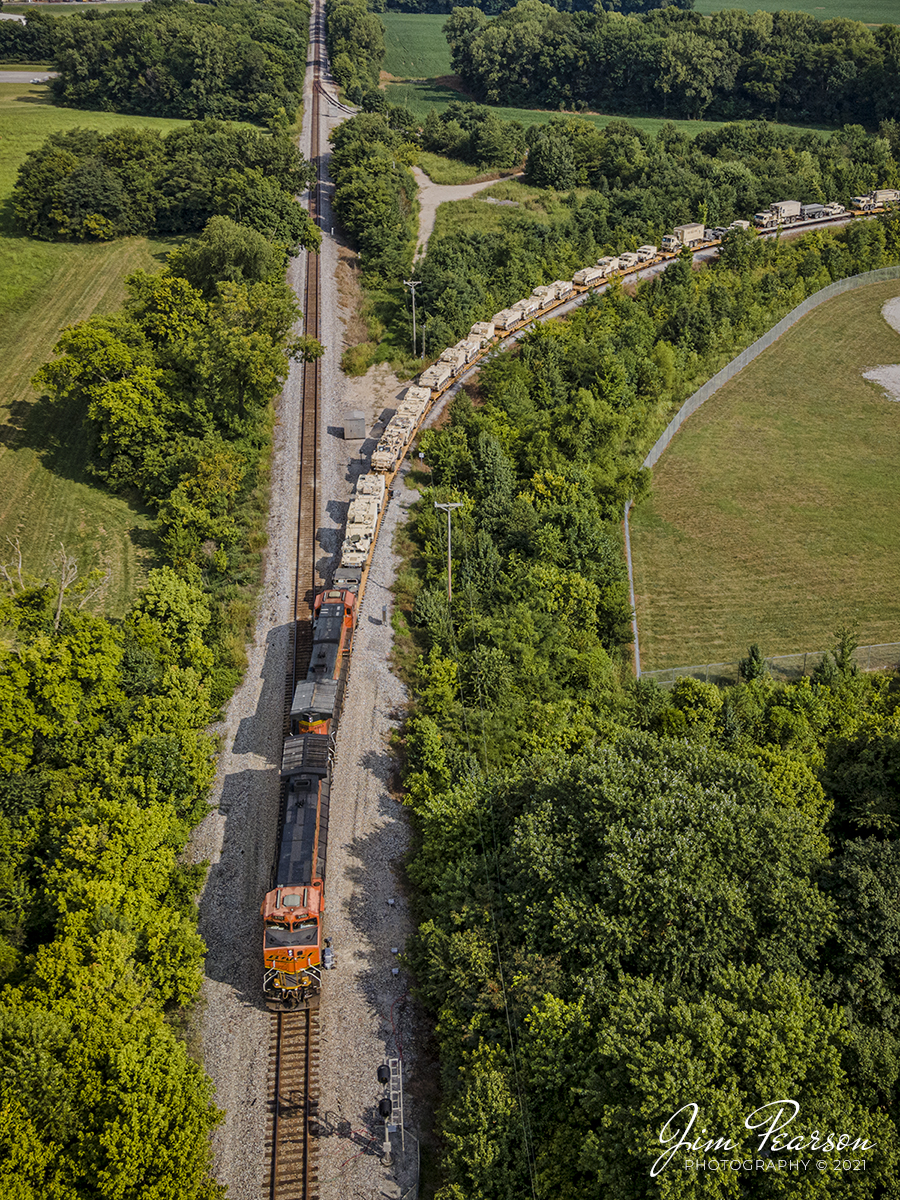
BNSF 5743 and 8363 head up a 7,600ft military train on August 11th, 2021, as it passes through the WF Ware grain operation in downtown Trenton, Kentucky, with CSX W844-03, a third military move heading north to Hopkinsville, KY. At Hopkinsville they backed the train onto the Ft. Campbell wye and Ft. Campbell rail took it on the rest of the way to the base.

For me this photo was as much about the visual look of the grain operation as it was about the military train and that's the reason, I went up a bit higher for this shot than what I normally do. I wanted to show the military cargo trailing off into the distance and could have done so down lower next to the tracks, but I really liked the higher angle, even though you can't see the cargo trailing off into nothing. What do you think? 

Tech Info: Wide Photo: DJI Mavic Air 2 Drone, RAW, 4.5mm (24mm equivalent lens) f/2.8, 1/500, ISO 100.

Southbound Military move on the CSX Henderson Subdivision at Trenton, KY

BNSF 5743 and 8363 head up a 7,600ft military train on August 11th, 2021, as it passes through the WF Ware grain operation in downtown Trenton, Kentucky, with CSX W844-03, a third military move heading north to Hopkinsville, KY. At Hopkinsville they backed the train onto the Ft. Campbell wye and Ft. Campbell rail took it on the rest of the way to the base.

For me this photo was as much about the visual look of the grain operation as it was about the military train and that’s the reason, I went up a bit higher for this shot than what I normally do. I wanted to show the military cargo trailing off into the distance and could have done so down lower next to the tracks, but I really liked the higher angle, even though you can’t see the cargo trailing off into nothing. What do you think?

Tech Info: Wide Photo: DJI Mavic Air 2 Drone, RAW, 4.5mm (24mm equivalent lens) f/2.8, 1/500, ISO 100.

Ft. Campbell Rail southbound at Rock Bridge Branch bridge Hopkinsville, KY

I love it when a plan finally falls into place! If you've caught my last few posts, you'll recall that I've talked about issues I had a couple days ago when I was trying to get shots of Ft. Campbell Rail picking up military loads from the Ft. Campbell Wye after BNSF brought their equipment north on the CSX Henderson Subdivision. Well, today everything fell into place from my perspective as you can see in the attached photo. Train was where I wanted it, light was perfect, and I had great clouds!!

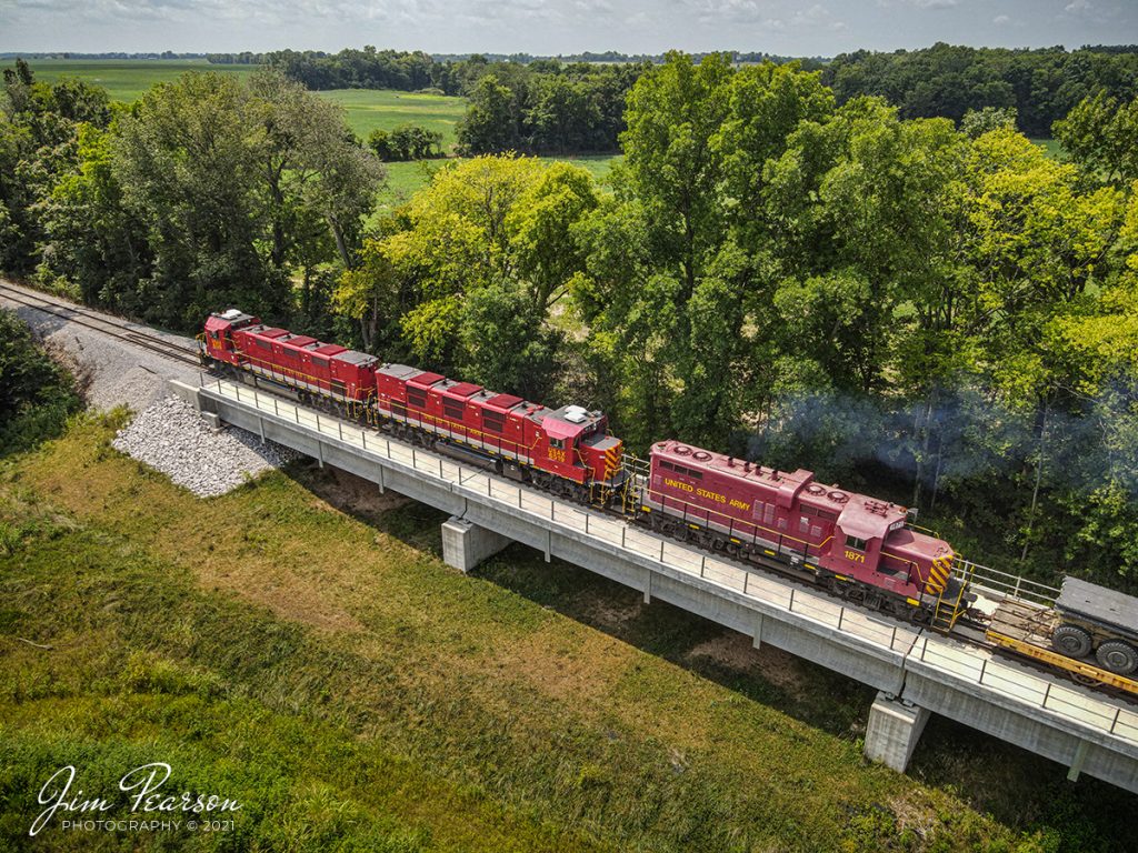
Here we have United States Army units USAX 6520, 6519 and 1871 headed from the Hopkinsville, KY on August 11th, 2021, as the train passes over the Rock Bridge Branch bridge, just south of Lovers Lane overpass.

This is another follow-up to my post yesterday where I discussed that my gear that just didn't want to co-operate! Well today, I used my iPhone 11pro instead of the iPhone 6s that I normally keep on my drone controller, and I didn't have any overheating problems at all and was able to fly normally. I guess the newer iPhones do a better job with the heat that the older ones as with the 11 I didn't get any warnings at all during the flights, and it was much hotter than the other day. 

Tech Info: Wide Photo: DJI Mavic Air 2 Drone, RAW, 4.5mm (24mm equivalent lens) f/2.8, 1/1000, ISO 100.

Ft. Campbell Rail southbound at Rock Bridge Branch bridge Hopkinsville, KY

I love it when a plan finally falls into place! If you’ve caught my last few posts, you’ll recall that I’ve talked about issues I had a couple days ago when I was trying to get shots of Ft. Campbell Rail picking up military loads from the Ft. Campbell Wye after BNSF brought their equipment north on the CSX Henderson Subdivision. Well, today everything fell into place from my perspective as you can see in the attached photo. Train was where I wanted it, light was perfect, and I had great clouds!!

Here we have United States Army units USAX 6520, 6519 and 1871 headed from the Hopkinsville, KY on August 11th, 2021, as the train passes over the Rock Bridge Branch bridge, just south of Lovers Lane overpass.

This is another follow-up to my post yesterday where I discussed that my gear that just didn’t want to co-operate! Well today, I used my iPhone 11pro instead of the iPhone 6s that I normally keep on my drone controller, and I didn’t have any overheating problems at all and was able to fly normally. I guess the newer iPhones do a better job with the heat that the older ones as with the 11 I didn’t get any warnings at all during the flights, and it was much hotter than the other day.

Tech Info: Wide Photo: DJI Mavic Air 2 Drone, RAW, 4.5mm (24mm equivalent lens) f/2.8, 1/1000, ISO 100.

Ft. Campbell Rail southbound at Rock Bridge Branch, Hopkinsville, KY

Photo 1

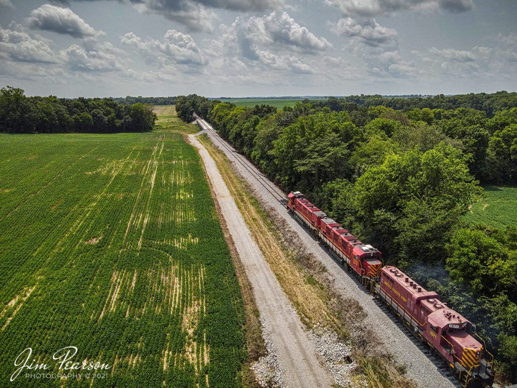
United States Army units USAX 6520, 6519 and 1871 head south after picking up a load of equipment from the Ft. Campbell wye in Hopkinsville, KY that was dropped off by CSX on August 9th, 2021, as the train approaches the Rock Bridge Branch bridge, just south of Lovers Lane overpass.

This is a follow-up to my post yesterday where I discussed that my gear just didn’t want to co-operate on this chase! This was my first spot with the drone and as soon as I launched it the DJI Fly app complained that the device (iPhone) was too hot, and performance would be reduced! Well, it’s been an ongoing issue since they updated their software a few weeks ago, so as you can see from these two shots, I didn’t get the drone in place where I wanted it, which is the far end of the bridge, looking back toward the train as it came toward me.

The drone moved so slow a sluggish that I couldn’t get far enough ahead of the train to get the camera into position and so what I got instead are a couple of going away shots of the power instead. Don’t get me wrong, I like both shots that I did get, but neither of them was what I had in mind. I wanted the power with the military loads trailing off into the distance. So, I will revisit this location and try again to get the shot I want!

I just got word this afternoon that there’s another loaded train headed for Hopkinsville for Ft. Campbell, which should arrive sometime tonight. My plan is to head back to this location early in the morning to hopefully get the shot I am looking for as they don’t normally pickup trains from the wye for Ft. Campbell after dark.

Tech Info: Wide Photo: DJI Mavic Air 2 Drone, RAW, 4.5mm (24mm equivalent lens) f/2.8, 1/1250, ISO 110. Tight Photo: DJI Mavic Air 2 Drone, RAW, 4.5mm (24mm equivalent lens) f/2.8, 1/500, ISO 100.

Photo 2
Ft. Campbell Rail southbound from Hopkinsville, KY

United States Army units USAX 6520, 6519 and 1871 head south after picking up a load of equipment from the Ft. Campbell wye in Hopkinsville, KY that was dropped off early this morning by CSX on August 9th, 2021.

My gear just didn’t want to co-operate on this chase today! At my first spot with the drone as soon as I launched it the DJI Fly app complained that the device (iPhone) was too hot, and performance would be reduced! Well, it’s been an ongoing issue since they updated their software a few weeks ago, so I didn't get the drone in place where I wanted it. You'll see that shot tomorrow. 

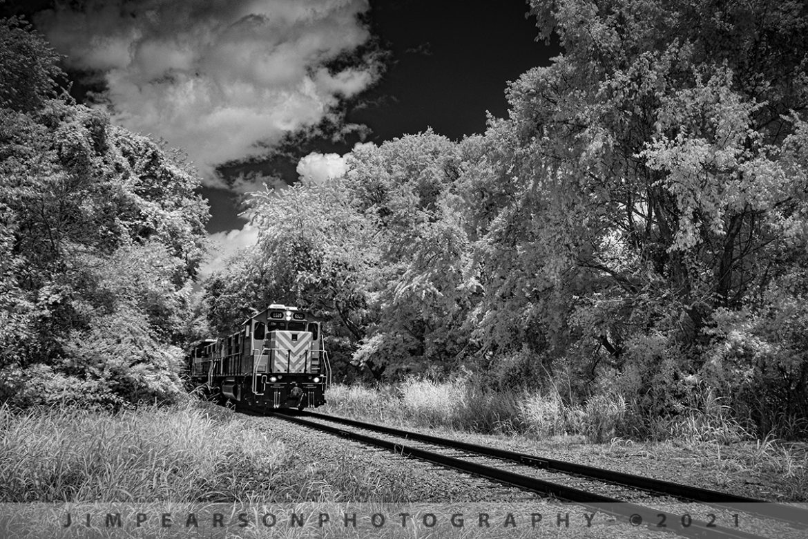
This infrared shot is close to what I had in my mind, but I started my shots a little early and I had planned on the power being closer to the crossing, but the camera started dragging, and this was my closest frame. I'm happy with the shot, but not what I saw in my mind's eye though! I could crop it in tighter, but after looking at the finished shot, I think I like better with having someplace for the train to go!

My next two spots I had planned to shoot as it made its way to the base, I never made it to in time because of traffic and lights! Go figure. Some days railfanning is like that!


Tech Info: Fuji XT-1, RAW, Converted to 720nm B&W IR, Fuji 18-55 @18mm, f/5, 1/1000, ISO 200.

Ft. Campbell Rail southbound from Hopkinsville, KY

United States Army units USAX 6520, 6519 and 1871 head south after picking up a load of equipment from the Ft. Campbell wye in Hopkinsville, KY that was dropped off early this morning by CSX on August 9th, 2021.

My gear just didn’t want to co-operate on this chase today! At my first spot with the drone as soon as I launched it the DJI Fly app complained that the device (iPhone) was too hot, and performance would be reduced! Well, it’s been an ongoing issue since they updated their software a few weeks ago, so I didn’t get the drone in place where I wanted it. You’ll see that shot tomorrow.

This infrared shot is close to what I had in my mind, but I started my shots a little early and I had planned on the power being closer to the crossing, but the camera started dragging, and this was my closest frame. I’m happy with the shot, but not what I saw in my mind’s eye though! I could crop it in tighter, but after looking at the finished shot, I think I like better with having someplace for the train to go!

My next two spots I had planned to shoot as it made its way to the base, I never made it to in time because of traffic and lights! Go figure. Some days railfanning is like that!

Tech Info: Fuji XT-1, RAW, Converted to 720nm B&W IR, Fuji 18-55 @18mm, f/5, 1/1000, ISO 200.

CSX W844 military train backs onto the Ft. Campbell Wye at Hopkinsville, KY

BNSF 5103 and 4653 lead CSX W844-05 military train (Memphis, TN-Hopkinsville, KY) as they shove their loads onto the Ft Campbell wye at Hopkinsville, KY, from the Henderson Subdivision, for the final part of their journey on August 7th, 2021.

The crews from Ft. Campbell had already come out to the wye earlier in the day and picked up another loaded train that was dropped off overnight and my guess is that this train probably won't set on the wye very long either.

Tech Info: DJI Mavic Air 2 Drone, RAW, 4.5mm (24mm equivalent lens) f/2.8, 1/500, ISO 100.

CSX W844 military train backs onto the Ft. Campbell Wye at Hopkinsville, KY

BNSF 5103 and 4653 lead CSX W844-05 military train (Memphis, TN-Hopkinsville, KY) as they shove their loads onto the Ft Campbell wye at Hopkinsville, KY, from the Henderson Subdivision, for the final part of their journey on August 7th, 2021.

The crews from Ft. Campbell had already come out to the wye earlier in the day and picked up another loaded train that was dropped off overnight and my guess is that this train probably won’t set on the wye very long either.

Tech Info: DJI Mavic Air 2 Drone, RAW, 4.5mm (24mm equivalent lens) f/2.8, 1/500, ISO 100.

CSX Track Inspection trainset W001 southbound at Kelly, KY

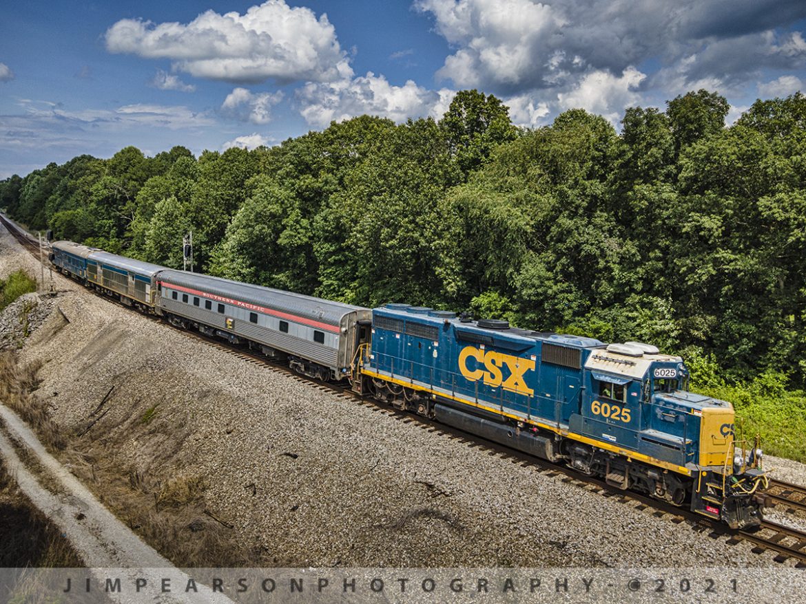
CSXT 6025 leads CSX W001 inspection train as it splits the signals on the north end of the siding at Kelly, Kentucky with Southern Pacific Birch Grove, CSX Florence and TGC2 Geometry Car trailing, as they make their way south on the Henderson Subdivision on July 13, 2021.

Research from a friend reveals: Built by The Budd Company in 1950 as 6 double bedroom, 10 roomette sleeping car 9020 for service on the Southern Pacific's Los Angeles-New Orleans "Sunset Limited." The car was acquired by Amtrak in 1971 and renumbered 2696. Converted to Heritage 10-6 sleeper with handicapped roomette in 1980 and renumbered to 2451 and named Birch Grove. 

The Car was retired in 1995 and sold to Cincinnati Railway Company. It was upgraded 2002-03 and had a complete interior upgrade in 2005. As of 2014 it was owned by the Cincinnati Railway Company.

CSX purchased the Birch Grove car from the Cincinnati Railway in September of 2020 and from what I find online they plan to use it as part of its executive fleet. They also bought the dome car Moonlight Dome from them for the same reason.

According to Wikipedia: A track geometry car (also known as a track recording car) is an automated track inspection vehicle on a rail transport system used to test several parameters of the track geometry without obstructing normal railroad operations. Some of the parameters generally measured include position, curvature, alignment of the track, smoothness, and the cross level of the two rails. The cars use a variety of sensors, measuring systems, and data management systems to create a profile of the track being inspected.

One of the earliest track geometry cars was Car T2 used by the U.S. Department of Transportation's Project HISTEP (High-Speed Train Evaluation Program). It was built by the Budd Company for Project HISTEP to evaluate track conditions between Trenton and New Brunswick, NJ, where the DOT had established a section of track for testing high-speed trains, and accordingly, the T2 ran at 150 miles per hour or faster.

Tech Info: DJI Mavic Air 2 Drone, RAW, 4.5mm (24mm equivalent lens) f/2.8, 1/800, ISO 100.

CSX Track Inspection trainset W001 southbound at Kelly, KY

CSXT 6025 leads CSX W001 inspection train as it splits the signals on the north end of the siding at Kelly, Kentucky with Southern Pacific Birch Grove, CSX Florence and TGC2 Geometry Car trailing, as they make their way south on the Henderson Subdivision on July 13, 2021.

Research from a friend reveals: Built by The Budd Company in 1950 as 6 double bedroom, 10 roomette sleeping car 9020 for service on the Southern Pacific’s Los Angeles-New Orleans “Sunset Limited.” The car was acquired by Amtrak in 1971 and renumbered 2696. Converted to Heritage 10-6 sleeper with handicapped roomette in 1980 and renumbered to 2451 and named Birch Grove.

The Car was retired in 1995 and sold to Cincinnati Railway Company. It was upgraded 2002-03 and had a complete interior upgrade in 2005. As of 2014 it was owned by the Cincinnati Railway Company.

CSX purchased the Birch Grove car from the Cincinnati Railway in September of 2020 and from what I find online they plan to use it as part of its executive fleet. They also bought the dome car Moonlight Dome from them for the same reason.

According to Wikipedia: A track geometry car (also known as a track recording car) is an automated track inspection vehicle on a rail transport system used to test several parameters of the track geometry without obstructing normal railroad operations. Some of the parameters generally measured include position, curvature, alignment of the track, smoothness, and the cross level of the two rails. The cars use a variety of sensors, measuring systems, and data management systems to create a profile of the track being inspected.

One of the earliest track geometry cars was Car T2 used by the U.S. Department of Transportation’s Project HISTEP (High-Speed Train Evaluation Program). It was built by the Budd Company for Project HISTEP to evaluate track conditions between Trenton and New Brunswick, NJ, where the DOT had established a section of track for testing high-speed trains, and accordingly, the T2 ran at 150 miles per hour or faster.

Tech Info: DJI Mavic Air 2 Drone, RAW, 4.5mm (24mm equivalent lens) f/2.8, 1/800, ISO 100.

CSX GMS2 track geometry car at PAL west yard, Madisonville, KY. 

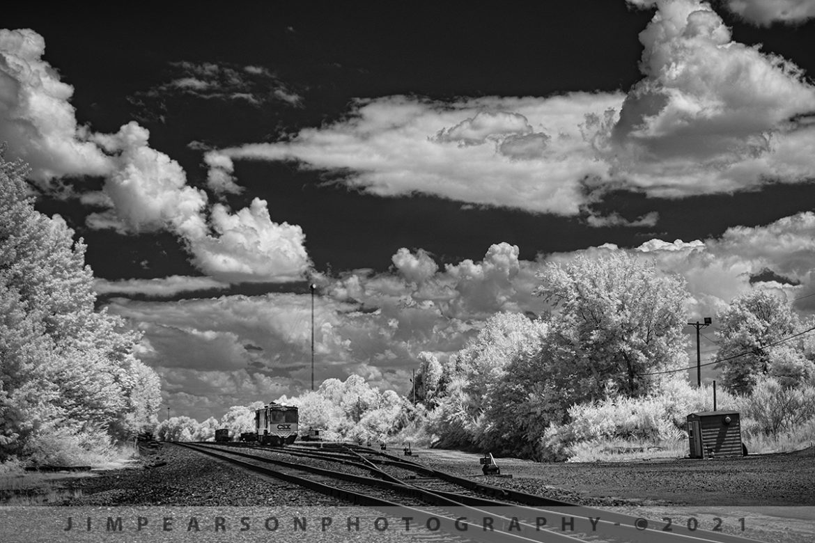
On August 4th, 2021, I was headed home with my niece Elaina this afternoon as we passed over the crossing at the Paducah and Louisville Railway yard at Madisonville, Kentucky when I spotted this scene with GMS2 track geometry car sitting pretty much by itself and did an immediate U-turn! The light, sky, clouds, and car were just screaming to me to be photographed in Infrared! After trying different angles and lenses this in the shot I ended up liking the best!

From Wikipedia: "A track geometry car (also known as a track recording car) is an automated track inspection vehicle on a rail transport system used to test several parameters of the track geometry without obstructing normal railroad operations. Some of the parameters generally measured include position, curvature, alignment of the track, smoothness, and the cross level of the two rails. The cars use a variety of sensors, measuring systems, and data management systems to create a profile of the track being inspected."

Tech Info: Fuji XT-1, RAW, Converted to 720nm B&W IR, Fuji 18-55 @32.9mm, f/5, 1/500, ISO 200.

CSX GMS2 track geometry car at PAL west yard, Madisonville, KY

On August 4th, 2021, I was headed home with my niece Elaina this afternoon as we passed over the crossing at the Paducah and Louisville Railway yard at Madisonville, Kentucky when I spotted this scene with GMS2 track geometry car sitting pretty much by itself and did an immediate U-turn! The light, sky, clouds, and car were just screaming to me to be photographed in Infrared! After trying different angles and lenses this in the shot I ended up liking the best!

From Wikipedia: “A track geometry car (also known as a track recording car) is an automated track inspection vehicle on a rail transport system used to test several parameters of the track geometry without obstructing normal railroad operations. Some of the parameters generally measured include position, curvature, alignment of the track, smoothness, and the cross level of the two rails. The cars use a variety of sensors, measuring systems, and data management systems to create a profile of the track being inspected.”

Tech Info: Fuji XT-1, RAW, Converted to 720nm B&W IR, Fuji 18-55 @32.9mm, f/5, 1/500, ISO 200.

Paducah and Louisville Railway PRX1 at Calvert City, Kentucky

Paducah and Louisville Railway 3811, 4504 and 4516 lead loaded coal train PRX1 around the outer loop at the Calvert City Terminal in Calvert City, Kentucky on July 23, 2021, after picking up a load of coal for the TVA Shawnee Power Plant in West Paducah, KY.

According to Wikipedia: "The Paducah & Louisville Railway (reporting mark PAL) is a Class II railroad that operates freight service between Paducah and Louisville, Kentucky. The line is located entirely within the Commonwealth of Kentucky.

The 270-mile (430 km) line was purchased from Illinois Central Gulf Railroad in August 1986. The 223-mile (359 km) main route runs between Paducah and Louisville with branch lines from Paducah to Kevil and Mayfield, Kentucky, and another from Cecilia to Elizabethtown, Kentucky. The PAL interchanges with Burlington Northern Santa Fe (BNSF) and Canadian National (CN), formerly Illinois Central Railroad, in Paducah. In Madisonville, the line interchanges with CSX Transportation (CSXT).

In Louisville, the line interchanges with the Indiana Railroad (INRD), CSX Transportation (CSXT) and Norfolk Southern (NS). Class III line connections are at Princeton with the Fredonia Valley Railroad (FVRR) and at Louisville with the Louisville and Indiana Railroad (LIRC). The line today carries over 200,000 carloads of traffic on a CTC-controlled mainline with welded rail and even a section of multiple main tracks nearly 20 miles (32 km) long between Paducah and just east of Calvert City. This is a huge improvement from the little amount of traffic and poor condition the line was in by the time the ICG had sold it.

Today it is a big regional class II railroad connecting with four class I railroads (listed above), as well as the three shortline connections it makes which are also listed above. It has 270 route-miles of track, of which 233 miles (375 km) are its mainline running between its namesake towns of Paducah and Louisville, as well as branch lines to Mayfield, Kevil, and Elizabethtown. The railroad serves "many chemical plants and other manufacturing companies, several coal mines, numerous clay and stone quarries, lumber and propane distributors, farm [including a few large grain elevators] and mine equipment suppliers, warehouses, transloads, bulk terminals, riverports, and one military base."

The parent company of the PAL, P&L Transportation, also operates the Evansville Western Railway and the Appalachian and Ohio Railroad."

Tech Info: DJI Mavic Air 2 Drone, RAW, 4.5mm (24mm equivalent lens) f/2.8, 1/240, ISO 100.

Paducah and Louisville Railway PRX1 at Calvert City, Kentucky

Paducah and Louisville Railway 3811, 4504 and 4516 lead loaded coal train PRX1 around the outer loop at the Calvert City Terminal in Calvert City, Kentucky on July 23, 2021, after picking up a load of coal for the TVA Shawnee Power Plant in West Paducah, KY.

According to Wikipedia: “The Paducah & Louisville Railway (reporting mark PAL) is a Class II railroad that operates freight service between Paducah and Louisville, Kentucky. The line is located entirely within the Commonwealth of Kentucky.

The 270-mile (430 km) line was purchased from Illinois Central Gulf Railroad in August 1986. The 223-mile (359 km) main route runs between Paducah and Louisville with branch lines from Paducah to Kevil and Mayfield, Kentucky, and another from Cecilia to Elizabethtown, Kentucky. The PAL interchanges with Burlington Northern Santa Fe (BNSF) and Canadian National (CN), formerly Illinois Central Railroad, in Paducah. In Madisonville, the line interchanges with CSX Transportation (CSXT).

In Louisville, the line interchanges with the Indiana Railroad (INRD), CSX Transportation (CSXT) and Norfolk Southern (NS). Class III line connections are at Princeton with the Fredonia Valley Railroad (FVRR) and at Louisville with the Louisville and Indiana Railroad (LIRC). The line today carries over 200,000 carloads of traffic on a CTC-controlled mainline with welded rail and even a section of multiple main tracks nearly 20 miles (32 km) long between Paducah and just east of Calvert City. This is a huge improvement from the little amount of traffic and poor condition the line was in by the time the ICG had sold it.

Today it is a big regional class II railroad connecting with four class I railroads (listed above), as well as the three shortline connections it makes which are also listed above. It has 270 route-miles of track, of which 233 miles (375 km) are its mainline running between its namesake towns of Paducah and Louisville, as well as branch lines to Mayfield, Kevil, and Elizabethtown. The railroad serves “many chemical plants and other manufacturing companies, several coal mines, numerous clay and stone quarries, lumber and propane distributors, farm [including a few large grain elevators] and mine equipment suppliers, warehouses, transloads, bulk terminals, riverports, and one military base.”

The parent company of the PAL, P&L Transportation, also operates the Evansville Western Railway and the Appalachian and Ohio Railroad.”

Tech Info: DJI Mavic Air 2 Drone, RAW, 4.5mm (24mm equivalent lens) f/2.8, 1/240, ISO 100.
CSXT 3115 pulls upgrade leading Q025 at Mortons Gap, KY

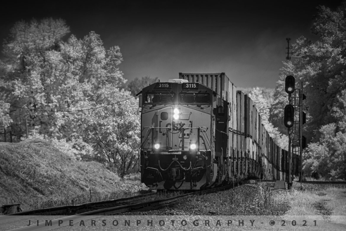
CSX Q025 pulls up grade out of the valley with CSXT 3115 leading the way at Mortons Junction on the Henderson Subdivision as it heads south at Mortons Gap, KY in this infrared shot on July 16th, 2021 with over two miles of containers trailing behind.

Tech Info: Fuji XT-1, RAW, Converted to 720nm B&W IR, Sigma 150-600 @ 300mm, f/8, 1/500, ISO 400.

CSX Q028-28 northbound at Madisonville, Ky on the Henderson Subdivision

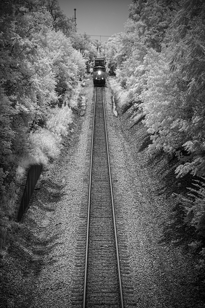
In this Infrared shot from July 29th, 2021 we catch CSXT 3250 as it leads Q028-28 north, approaching the North Main Street overpass at Madisonville, Ky on the Henderson Subdivision. 

I purposely chose to capture this train a bit further back in the frame as I really like the leading lines from the tracks, and it being surrounded by trees in the traditional infrared white! I did use a bit of vignette, as I do on most of my images, to help draw the eye and focal point to the subject of the photo.

Tech Info: Fuji XT-1, RAW, Converted to 720nm B&W IR, Fuji 18-55 @55mm, f/5, 1/500, ISO 200.

CSX Q028-28 northbound at Madisonville, Ky on the Henderson Subdivision

In this Infrared shot from July 29th, 2021 we catch CSXT 3250 as it leads Q028-28 north, approaching the North Main Street overpass at Madisonville, Ky on the Henderson Subdivision.

I purposely chose to capture this train a bit further back in the frame as I really like the leading lines from the tracks, and it being surrounded by trees in the traditional infrared white! I did use a bit of vignette, as I do on most of my images, to help draw the eye and focal point to the subject of the photo.

Tech Info: Fuji XT-1, RAW, Converted to 720nm B&W IR, Fuji 18-55 @55mm, f/5, 1/500, ISO 200.

Southbound load of coal at Chiles Junction, West Paducah, KY

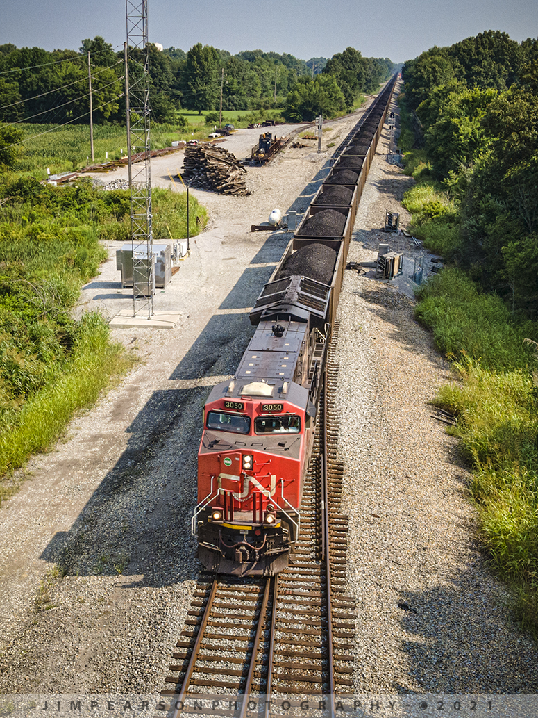
Canadian National 3050 leads a loaded coal train as it passes through Chiles Junction on its way south on the CN Bluford Subdivision at West Paducah, Kentucky on July 23rd, 2021.

Tech Info: DJI Mavic Air 2 Drone, RAW, 4.5mm (24mm equivalent lens) f/2.8, 1/500, ISO 100.

Infrared shot of CSX Q026 with CSXT 1776 Honoring our Veterans Unit at Mortons Gap, KY

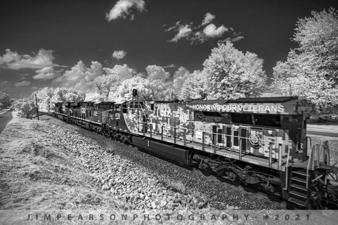
CSX Q026 heads through downtown Mortons Gap, Ky with CSXT 1776, Honoring our Veterans Unit, trailing as it heads north on the Henderson Subdivision in this Infrared photograph shot just short of Mortons Junction, where the cut off track that bypasses downtown Earlington and Madisonville, Ky on July 15th, 2021.

I'm really enjoying this new look for me and my railfan work! I hope you are as well!

Tech Info: Fuji XT-1, RAW, Converted to 720nm B&W IR, Irex 11mm, f/4.5, 1/250, ISO 800.

Infrared shot of CSX Q026 with CSXT 1776 Honoring our Veterans Unit at Mortons Gap, KY

CSX Q026 heads through downtown Mortons Gap, Ky with CSXT 1776, Honoring our Veterans Unit, trailing as it heads north on the Henderson Subdivision in this Infrared photograph shot just short of Mortons Junction, where the cut off track that bypasses downtown Earlington and Madisonville, Ky on July 15th, 2021.

I’m really enjoying this new look for me and my railfan work! I hope you are as well!

Tech Info: Fuji XT-1, RAW, Converted to 720nm B&W IR, Irex 11mm, f/4.5, 1/250, ISO 800.