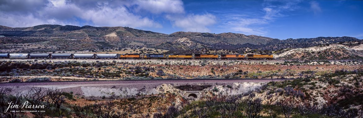

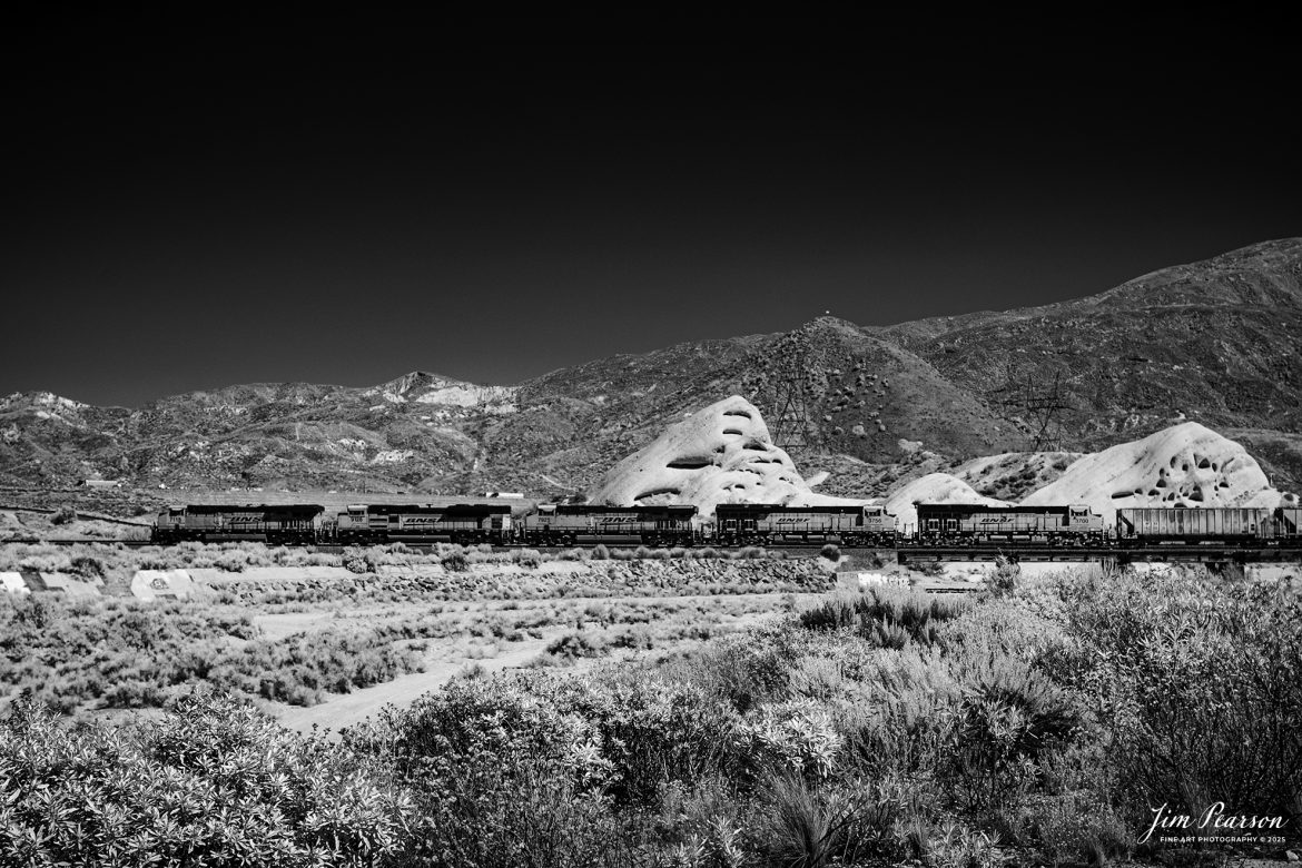
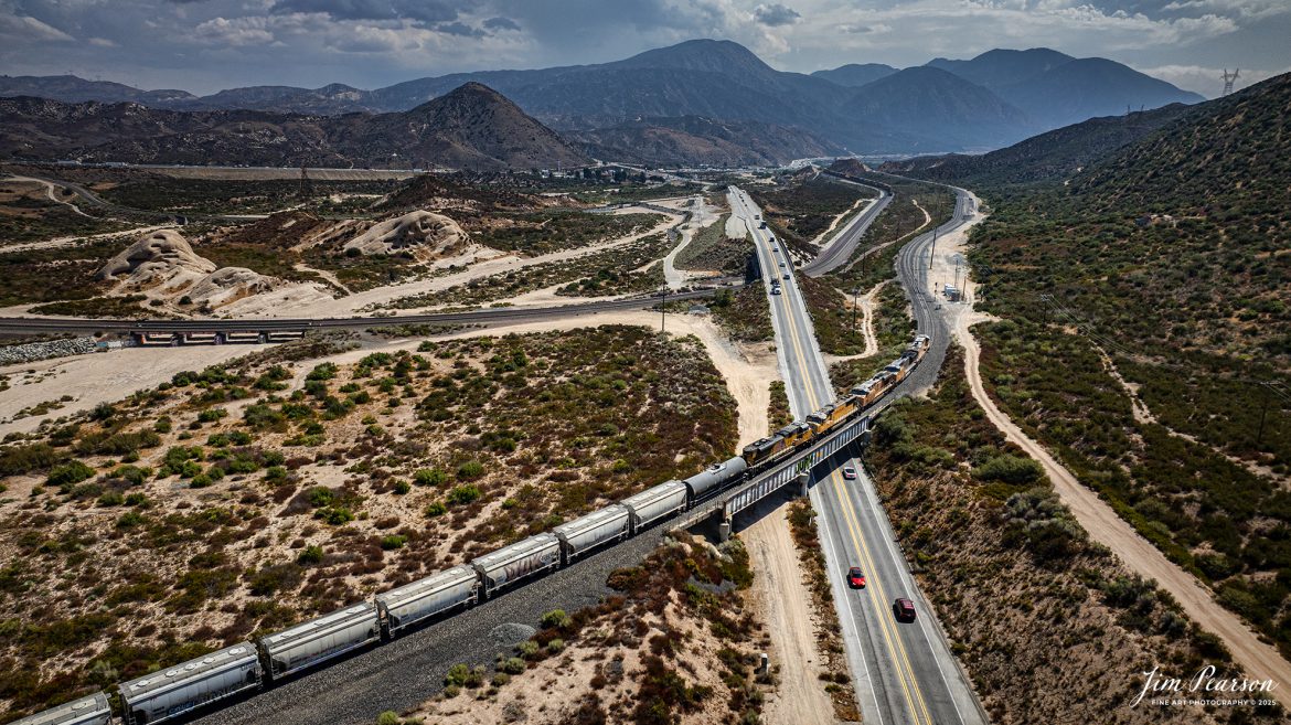
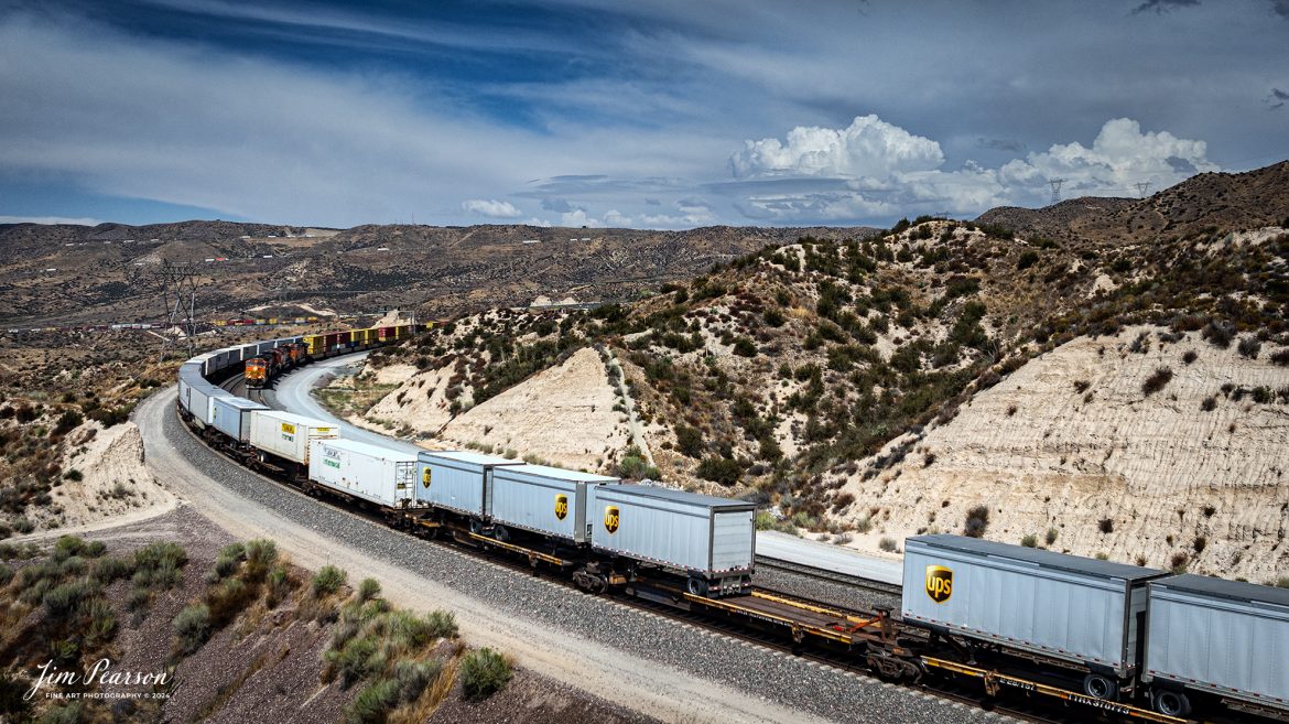
September 18th, 2024, BNSF 7115, 9128 and Ferromex 4050 lead an northbound train through Tehachapi Loop on the Union Pacific Mojave Subdivision at Keene, California.
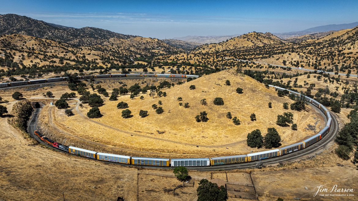
According to Wikipedia: The Tehachapi Loop is a 3,779-foot-long (0.72 mi; 1.15 km) spiral, or helix, on the Union Pacific Railroad Mojave Subdivision through Tehachapi Pass, of the Tehachapi Mountains in Kern County, south-central California. The line connects Bakersfield and the San Joaquin Valley to Mojave in the Mojave Desert.
Rising at a steady two-percent grade, the track gains 77 feet (23 m) in elevation and makes a 1,210-foot-diameter (370 m) circle. Any train that is more than 3,800 feet (1,200 m) long—about 56 boxcars—passes over itself going around the loop. At the bottom of the loop, the track passes through Tunnel 9, the ninth tunnel built as the railroad was extended from Bakersfield.
The line averages about 36 freight trains each day. Passenger trains such as Amtrak’s San Joaquin are banned from the loop, although the Coast Starlight can use it as a detour. Its frequent trains and scenic setting make the Tehachapi Loop popular with railfans. In 1998, it was named a National Historic Civil Engineering Landmark. It is also designated as California Historical Landmark #508.
One of the engineering feats of its day, the Loop was built by Southern Pacific Railroad to ease the grade over Tehachapi Pass. Construction began in 1874, and the line opened in 1876.
Tech Info: DJI Mavic 3 Classic Drone, RAW, 24mm, f/2.8, 1/2500, ISO 100.
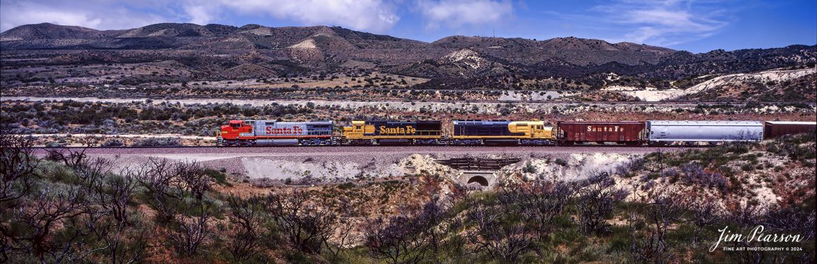
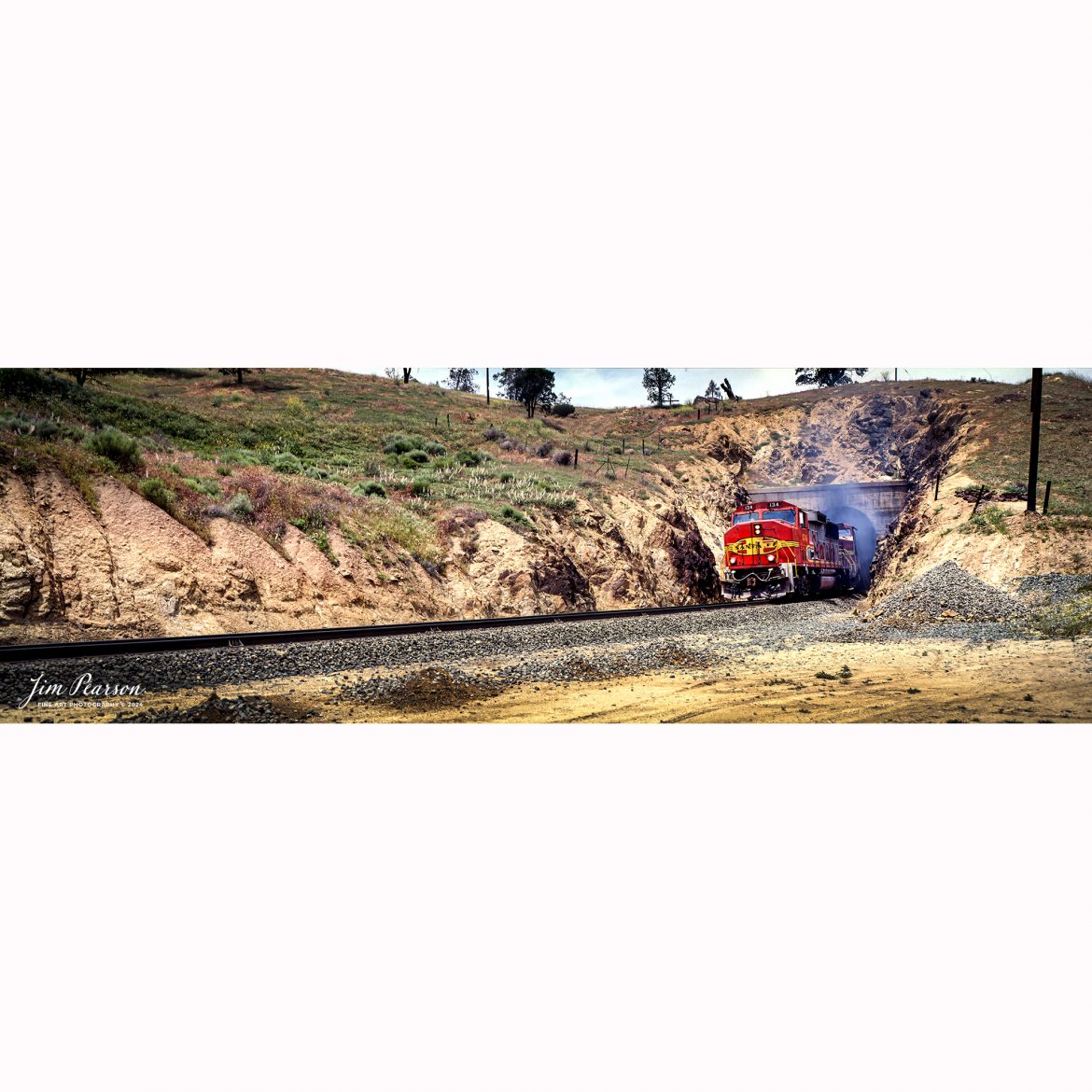
![Film Wednesday – Five Santa Fe Warbonnet units lead a loaded intermodal as it approaches one of the many tunnels in the Tehachapi mountains of California that was shot sometime in the mid 1990’s.
According to Wikipedia: The Atchison, Topeka and Santa Fe Railway (reporting mark ATSF), often referred to as the Santa Fe or AT&SF, was one of the largest Class 1 railroads in the United States between 1859 and 1996.
The Santa Fe was a pioneer in intermodal freight transport; at various times, it operated an airline, the short-lived Santa Fe Skyway, and the Santa Fe Railroad tugboats.[2] Its bus line extended passenger transportation to areas not accessible by rail, and ferryboats on the San Francisco Bay allowed travelers to complete their westward journeys to the Pacific Ocean. The AT&SF was the subject of a popular song, Harry Warren and Johnny Mercer's "On the Atchison, Topeka and the Santa Fe", written for the film The Harvey Girls (1946).
The railroad officially ceased independent operations on December 31, 1996, when it merged with the Burlington Northern Railroad to form the Burlington Northern and Santa Fe Railway.
Tech Info: Camera, Nikon F3, Kodachrome Slide Film, no other data recorded
#slidescan #filmphotography #trains #railroads #jimpearsonphotography](http://www.jimpearsonphotography.com/wp-content/uploads/2025/01/WEB-1995-KR-Slide-SF-in-Techachapi-1-1170x748.jpg)
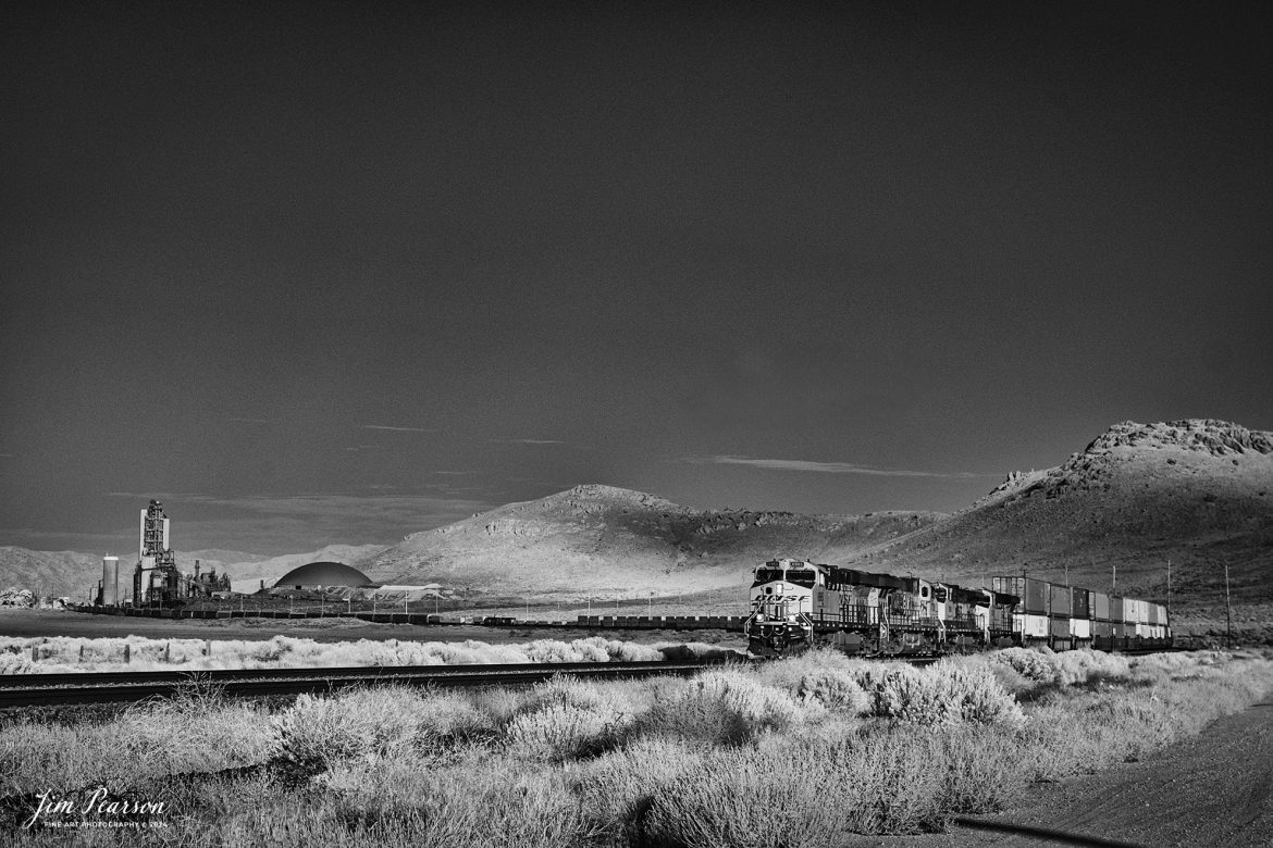
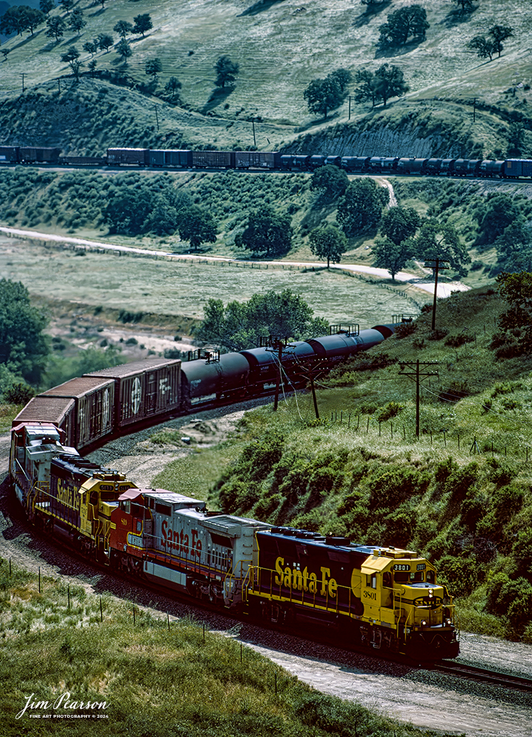
![Film Wednesday – Warbonnet Santa Fe 526 leads a mixed freight as it exits one of the many tunnels in the Tehachapi mountains of California, in this film scan from a 6x17cm slide that was shot sometime in the early 1990’s.
According to Wikipedia: The Atchison, Topeka and Santa Fe Railway (reporting mark ATSF), often referred to as the Santa Fe or AT&SF, was one of the largest Class 1 railroads in the United States between 1859 and 1996.
The Santa Fe was a pioneer in intermodal freight transport; at various times, it operated an airline, the short-lived Santa Fe Skyway, and the Santa Fe Railroad tugboats.[2] Its bus line extended passenger transportation to areas not accessible by rail, and ferryboats on the San Francisco Bay allowed travelers to complete their westward journeys to the Pacific Ocean. The AT&SF was the subject of a popular song, Harry Warren and Johnny Mercer's "On the Atchison, Topeka and the Santa Fe", written for the film The Harvey Girls (1946).
The railroad officially ceased independent operations on December 31, 1996, when it merged with the Burlington Northern Railroad to form the Burlington Northern and Santa Fe Railway.
Tech Info: Camera, Fuji 6x17, Kodachrome Slide Film, no other data recorded, Scanned with an Epson Perfection V700 PHOTO scanner.
#slidescan #filmphotography #trains #railroads #jimpearsonphotography](http://www.jimpearsonphotography.com/wp-content/uploads/2024/12/WEB-1990-SF-6x17-Exits-Tunnel-003-1170x381.jpg)