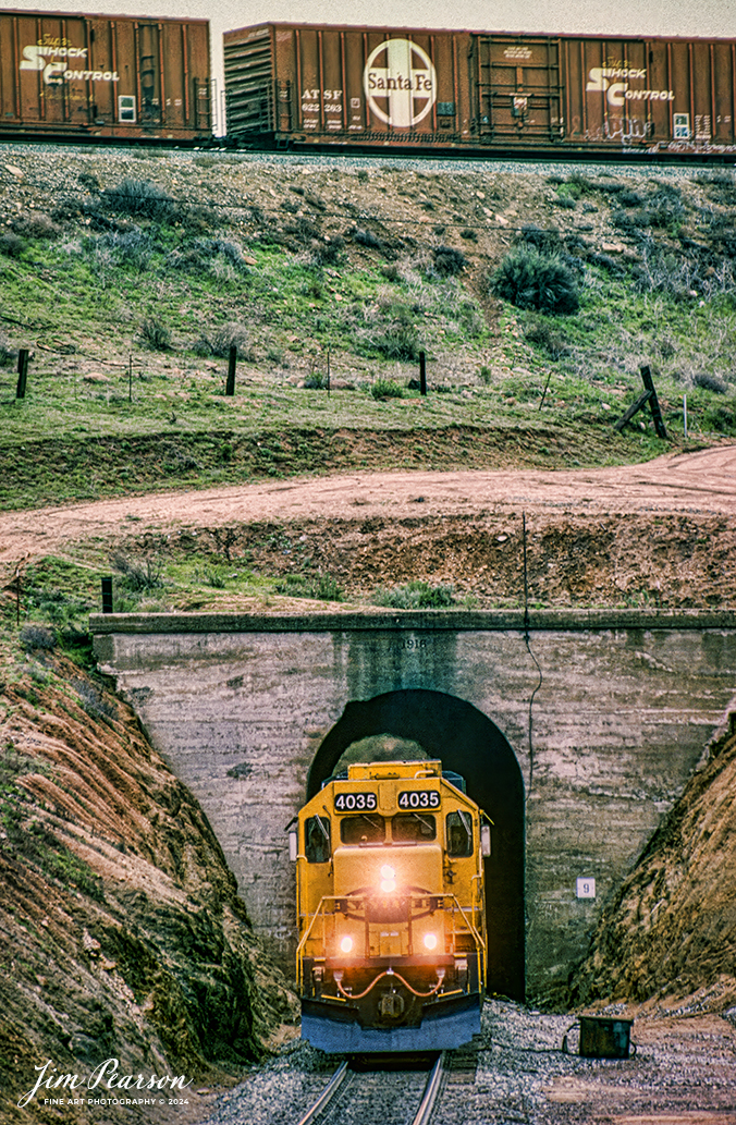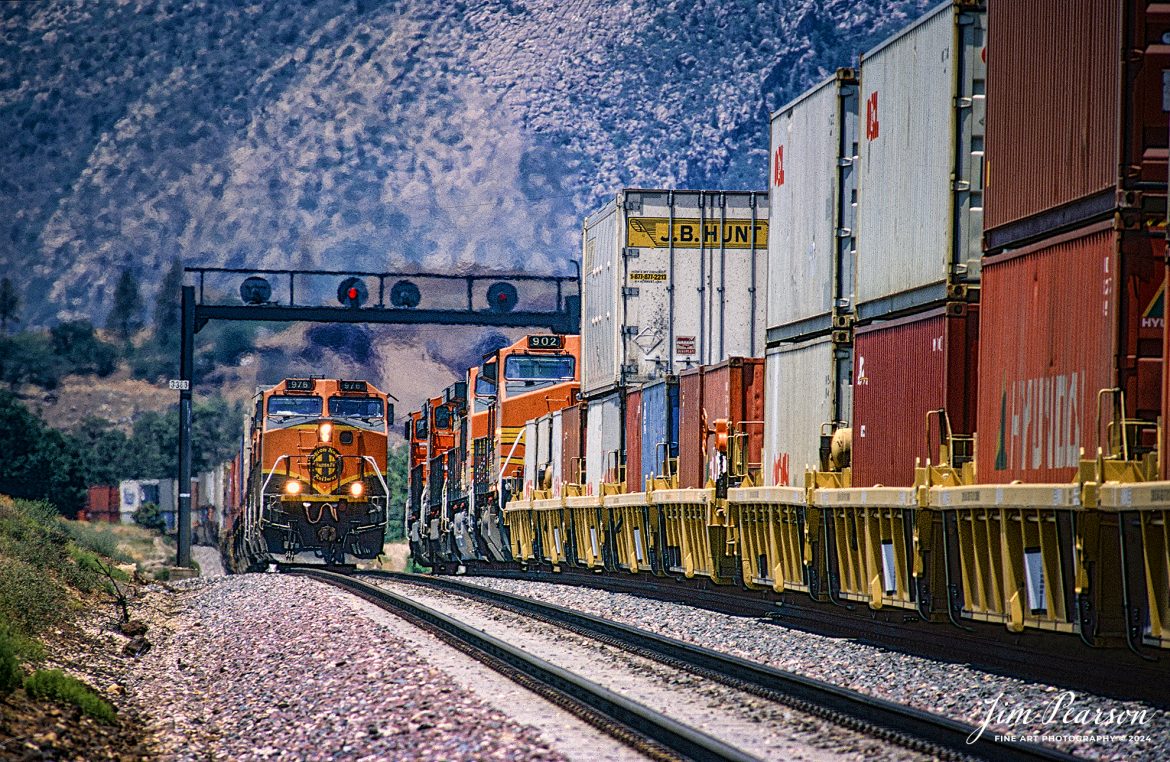
![A Loram Rail grinder makes its way through the Cajon Pass in Southern California in April of 1995.
I spent a lot of years railfanning the pass between 1981 and 1995! It's a great place to catch trains and I've been back several times over the years since then.
In fact I'm headed back again this coming September for a week or so to see how much it has changed since I was last there several years ago. In fact, it was before I had a drone, so I'm really looking forward to railfanning from the air this next trip!
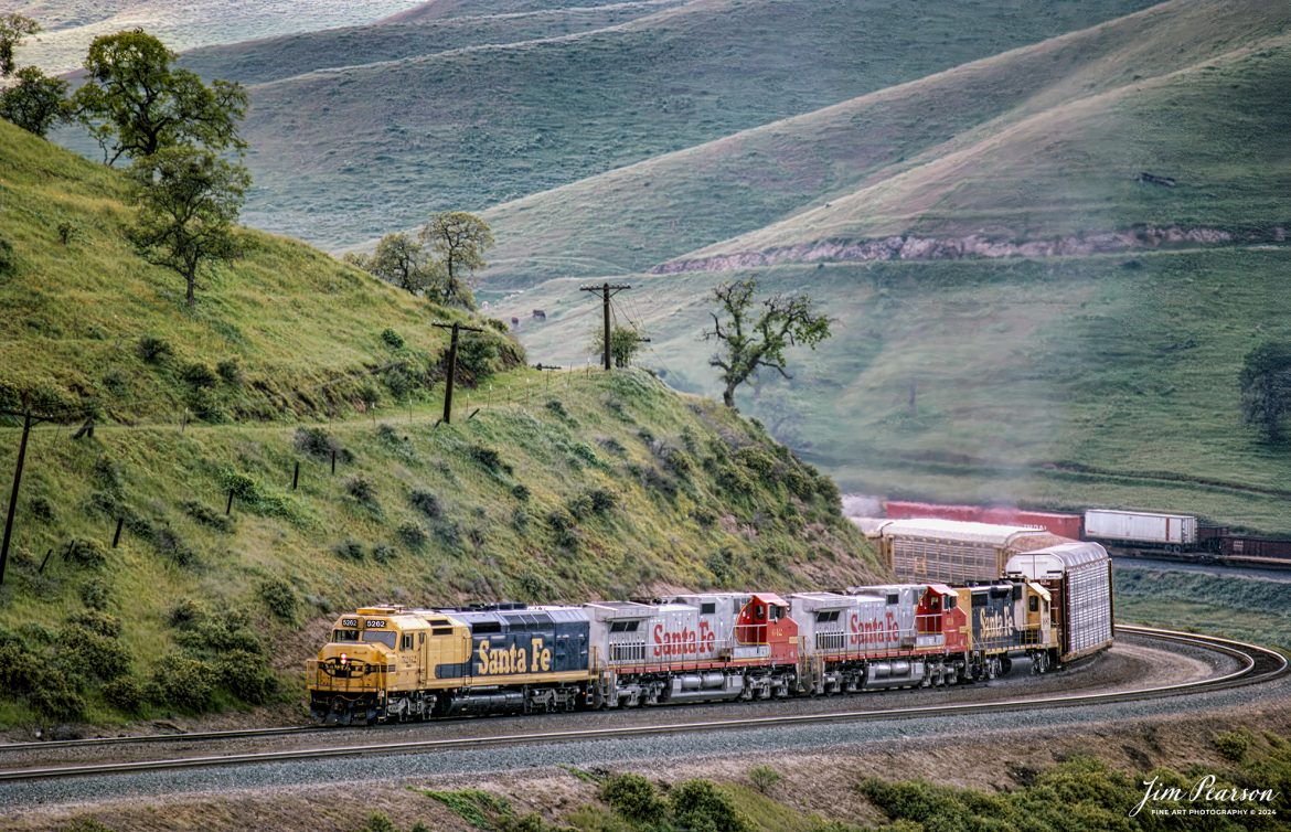
According to Wikipedia: Cajon Pass is a mountain pass between the San Bernardino Mountains to the east and the San Gabriel Mountains to the west in Southern California. Created by the movements of the San Andreas Fault, it has an elevation of 3,777 ft (1,151 m).[1] Located in the Mojave Desert, the pass is an important link from the Greater San Bernardino Area to the Victor Valley, and northeast to Las Vegas. The Cajon Pass area is on the Pacific Crest Trail.
Cajon Pass is at the head of Horsethief Canyon, traversed by California State Route 138 and railroad tracks owned by BNSF Railway and Union Pacific Railroad. Improvements in 1972 reduced the railroad's maximum elevation from about 3,829 to 3,777 feet (1,167 to 1,151 m) while reducing curvature. Interstate 15 does not traverse Cajon Pass, but rather the nearby Cajon Summit. The entire area, Cajon Pass and Cajon Summit, is often referred to as Cajon Pass, but a distinction is made between Cajon Pass and Cajon Summit.
Nikon F3 Camera, Nikon 300mm lens, f/stop and shutter speed not recorded](http://www.jimpearsonphotography.com/wp-content/uploads/2024/04/WEB-04.1995-LoRam-in-Cajon-Pass-1170x762.jpg)
A Loram Rail grinder makes its way through the Cajon Pass in Southern California in April of 1995.
I spent a lot of years railfanning the pass between 1981 and 1995! It’s a great place to catch trains and I’ve been back several times over the years since then.
In fact I’m headed back again this coming September for a week or so to see how much it has changed since I was last there several years ago. In fact, it was before I had a drone, so I’m really looking forward to railfanning from the air this next trip!
According to Wikipedia: Cajon Pass is a mountain pass between the San Bernardino Mountains to the east and the San Gabriel Mountains to the west in Southern California. Created by the movements of the San Andreas Fault, it has an elevation of 3,777 ft (1,151 m).[1] Located in the Mojave Desert, the pass is an important link from the Greater San Bernardino Area to the Victor Valley, and northeast to Las Vegas. The Cajon Pass area is on the Pacific Crest Trail.
Cajon Pass is at the head of Horsethief Canyon, traversed by California State Route 138 and railroad tracks owned by BNSF Railway and Union Pacific Railroad. Improvements in 1972 reduced the railroad’s maximum elevation from about 3,829 to 3,777 feet (1,167 to 1,151 m) while reducing curvature. Interstate 15 does not traverse Cajon Pass, but rather the nearby Cajon Summit. The entire area, Cajon Pass and Cajon Summit, is often referred to as Cajon Pass, but a distinction is made between Cajon Pass and Cajon Summit.
Nikon F3 Camera, Nikon 300mm lens, f/stop and shutter speed not recorded