October 20, 2008 - Union Pacific 5411 leads a mixed freight westbound past Mormon Rocks in the southern California's famous Cajon Pass. 

According to Wikipedia: Cajon Pass (/k?'ho?n/; elevation 3,777 ft (1,151 m) is a mountain pass between the San Bernardino Mountains and the San Gabriel Mountains in Southern California in the United States. It was created by the movements of the San Andreas Fault. Located in the Mojave Desert, the pass is an important link from the Greater San Bernardino Area to the Victor Valley, and northeast to Las Vegas.

Cajon Pass is at the head of Horsethief Canyon, traversed by California State Route 138 (SR 138) and railroad tracks owned by BNSF Railway and Union Pacific Railroad. Railroad improvements in 1972 reduced its maximum elevation from about 3,829 to 3,777 feet (1,167 to 1,151 m) while also reducing the curvature. Interstate 15 does not traverse Cajon Pass, but rather the nearby Cajon Summit,  elevation 4,260 feet (1,300 m). However, the entire area including Cajon Pass and Cajon Summit is often collectively called Cajon Pass. Sometimes the entire area is called Cajon Pass, but a distinction is made between Cajon Pass and Cajon Summit in detail.

Mormon Rocks
In 1851, a group of Mormon settlers led by Amasa M. Lyman and Charles C. Rich traveled through the Cajon Pass in covered wagons on their way from Salt Lake City to southern California. This prominent rock formation in the pass, where the Mormon trail and the railway merge (near Sullivan's Curve), is known as Mormon Rocks.

October 20, 2008 – Union Pacific 5411 leads a mixed freight…

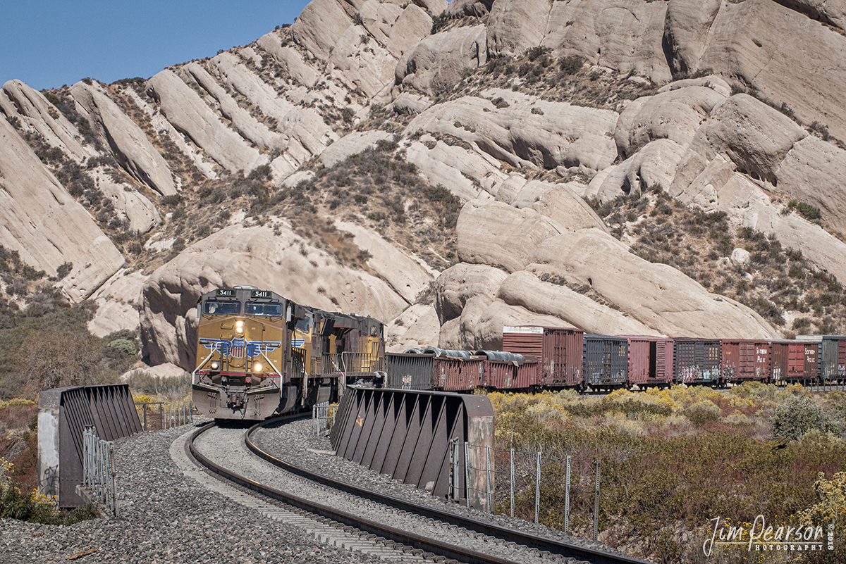
October 20, 2008 – Union Pacific 5411 leads a mixed freight westbound past Mormon Rocks in the southern California’s famous Cajon Pass.

According to Wikipedia: Cajon Pass (/k-‘ho-n/; elevation 3,777 ft (1,151 m) is a mountain pass between the San Bernardino Mountains and the San Gabriel Mountains in Southern California in the United States. It was created by the movements of the San Andreas Fault. Located in the Mojave Desert, the pass is an important link from the Greater San Bernardino Area to the Victor Valley, and northeast to Las Vegas.

Cajon Pass is at the head of Horsethief Canyon, traversed by California State Route 138 (SR 138) and railroad tracks owned by BNSF Railway and Union Pacific Railroad. Railroad improvements in 1972 reduced its maximum elevation from about 3,829 to 3,777 feet (1,167 to 1,151 m) while also reducing the curvature. Interstate 15 does not traverse Cajon Pass, but rather the nearby Cajon Summit, elevation 4,260 feet (1,300 m). However, the entire area including Cajon Pass and Cajon Summit is often collectively called Cajon Pass. Sometimes the entire area is called Cajon Pass, but a distinction is made between Cajon Pass and Cajon Summit in detail.

Mormon Rocks
In 1851, a group of Mormon settlers led by Amasa M. Lyman and Charles C. Rich traveled through the Cajon Pass in covered wagons on their way from Salt Lake City to southern California. This prominent rock formation in the pass, where the Mormon trail and the railway merge (near Sullivan’s Curve), is known as Mormon Rocks.