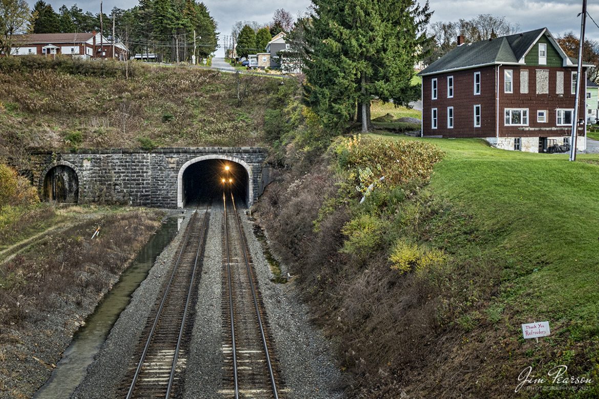
Norfolk Southern 7603 and 8410 approach the western entrance to the Gallitzin Tunnel at Gallitzin, Pennsylvania as they head west on the Norfolk Southern Pittsburgh Line on November 3rd, 2021, with an empty coal train.
According to Wikipedia: The Gallitzin Tunnels in Gallitzin, Pennsylvania, are a set of three adjacent tunnels through the Allegheny Mountains in western Pennsylvania. They were completed in 1854, 1855, and 1902 by the Pennsylvania Railroad as part of the cross-state route that includes the nearby Horseshoe Curve to the east. Their ownership has since passed to Penn Central Transportation Company, then to Conrail, and most recently to the Norfolk Southern Railway. The tunnels are currently used by Norfolk Southern freight trains and Amtrak Pennsylvanian passenger trains.
The first tunnel, which is the middle of the three bores through the mountain, was built by the PRR from 1851 to 1854. Originally named “Summit” Tunnel, it is 3,612 feet long at an elevation of 2,167 feet above mean sea level and is known today as the Allegheny Tunnel.
The second tunnel, the southernmost of the bores, was constructed by the Commonwealth of Pennsylvania from 1852 to 1855 as part of the New Portage Railroad (NPRR). In 1857, the PRR bought the New Portage Railroad from the Commonwealth and appropriated the “Allegheny” name for its “Summit” tunnel. The PRR took the New Portage Tunnel out of service shortly thereafter. In the 1890s, it was expanded to two tracks and used as the primary route for eastbound traffic.
The third tunnel, the Gallitzin Tunnel, was begun in 1902 and opened in 1904 immediately to the north of the Allegheny Tunnel.
In the early 1990s, Conrail (with money from the Commonwealth of Pennsylvania) enlarged the Allegheny and New Portage Tunnels to accommodate double-stack container on flatcar (COFC) trains. The New Portage Tunnel was opened for eastbound COFC traffic in 1993. The Allegheny Tunnel was enlarged from its original 1854 cross-section to contain two tracks for that could be used for double-stack rail transport in either direction. The work was completed in September 1995, and the Gallitzin Tunnel (which was not enlarged) was taken out of service.
Tech Info: Nikon D800, RAW, Nikon 10-24 @ 22mm, f/4.5, 1/800, ISO 560.